
- Installs
- —
- Apple does not publish download counts
- Rating
- 4.66
- Ratings
- 5.3K
- 5.3K reviews
- Version
- 5.137.0
- Updated 15 Jun 2026
- Released
- 24 Mar 2015
- Tracked since 10 May 2026
- Size
- 360 MB
- Needs 12.0
Screenshots
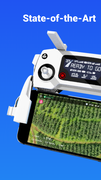
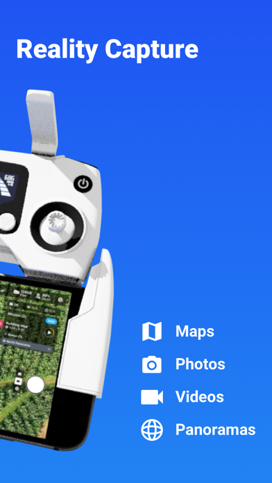
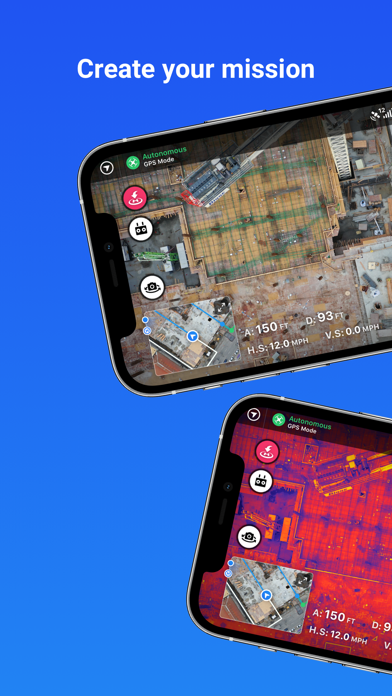
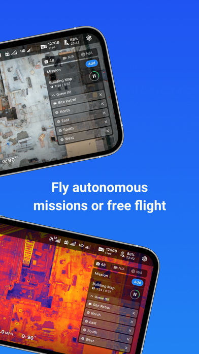

About DroneDeploy Flight App
The description on the store listing
DroneDeploy is the leading flight app for drones with millions of missions flown by over 130,000 pilots.
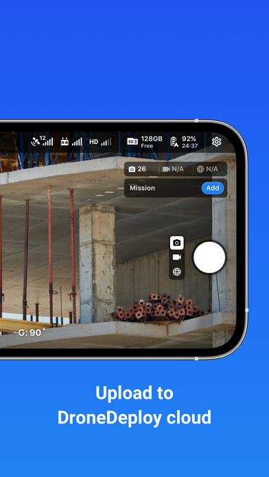
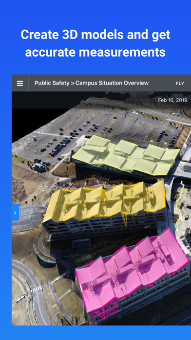
DroneDeploy is the leading cloud software platform for commercial drones, making the power of aerial data accessible and productive for everyone. The free DroneDeploy app provides easy automated flight and data capture, and enables you to create, explore and share high-quality interactive maps, orthomosaics and 3D models directly from your mobile device.
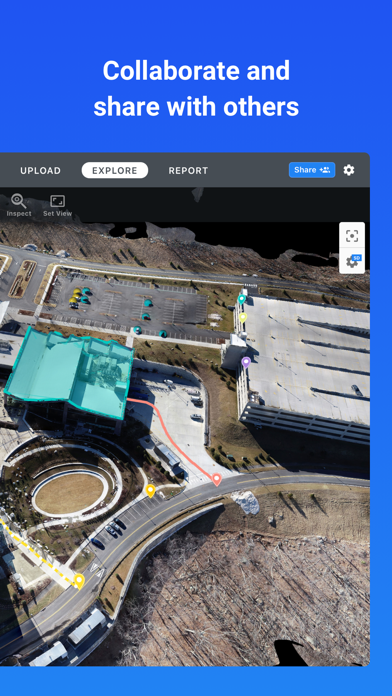
Fly your DJI drone autonomously with just two taps on your iOS device. Quickly process your imagery with DroneDeploy to generate accurate, high-resolution maps and 3D models. Analyze, annotate and share your maps with others directly …
Read the full description
DroneDeploy is the leading flight app for drones with millions of missions flown by over 130,000 pilots. DroneDeploy is the leading cloud software platform for commercial drones, making the power of aerial data accessible and productive for everyone. The free DroneDeploy app provides easy automated flight and data capture, and enables you to create, explore and share high-quality interactive maps, orthomosaics and 3D models directly from your mobile device. Fly your DJI drone autonomously with just two taps on your iOS device. Quickly process your imagery with DroneDeploy to generate accurate, high-resolution maps and 3D models. Analyze, annotate and share your maps with others directly from within the app. Extend your capabilities and take your analysis to the next level with AI reporting and over 80 best-in-class apps available for install within DroneDeploy’s App Market. DroneDeploy is the ultimate app for a wide range of high-accuracy aerial imaging and mapping applications in construction, solar, agriculture, surveying, mining, insurance, inspection and more. DroneDeploy has empowered users to map and analyze over 30 million acres in more than 160 countries. DRONE SUPPORT • Mavic 2 Pro / Zoom / Enterprise / Dual (thermal) • Mavic Air 2 • DJI Air 2S • Phantom 4 Pro V1 / V2 • Phantom 4 • Inspire 2 • Matrice 200 / 210 / 210 RTK V1 / V2 • Matrice 300 RTK Not compatible with the following hardware: • DJI Mavic Mini series HIGHLIGHTS • Easily plan and schedule repeatable flights • Fly and capture massive areas • Disable auto-flight with a single tap • Includes a full featured manual flight mode • Film professional quality video hands-free • Create automated spherical panoramas • Record all your flight logs in one place • Measure elevation, distance, volumes, surface area and roof geometry (roof reports) • Quickly create survey-grade maps and models with ground control points • Collaborate with teams through shared maps, annotations and comments • Wirelessly upload images from the drone • Export data in the format you need - JPG, Geotiff, OBJ, XYZ, LAS • Explore orthomosaic, NDVI, VARI, digital elevation maps and 3D models - - - Find out more at www.dronedeploy.com Please join us in improving and discussing the app at http://forum.dronedeploy.com
Installs, last 30 days
Apple does not publish download counts. Estimates are in testing.
Estimated store revenue Estimated Beta
App Store, worldwide, monthly rate from the last 12 chart days to 19 Nov 2026
Below the top 100 grossing apps in the markets we calibrate. In the United States that usually means under about $6.4M a month. App Store purchases and subscriptions only, before Apple's 15 to 30% fee. Ads and web payments are not included.
Ratings
5,343 ratings, 5,343 reviews
- 5 ★84%
- 4 ★7.6%
- 3 ★2.5%
- 2 ★1.8%
- 1 ★4.1%
Recent reviews
Latest public reviews from the store
- 11 Dec 2024
Needs work
So you don’t see the full resolution of a map on your iPhone or IPad unless you go to the website and view from there directly. Uploading files from a flight directly from SD card to an iPad or iPhone is glitchy along with unreliable. If you doing it from scratch like wanting to drop files directly on to the app you can’t. Basically anything besides export and sharing data that already exist your gonna need a computer.
- 19 May 2021
Decent but I have issues
I love the usability of the application and I like the desktop-tablet interface. I like the outputs also as most of them have been pretty high quality. Issues: 1. Application crash while using IPad. I usually have between 10 and 15 minutes of flight time in mission before the application crashes. When Inget it up again it’s doesn’t allow me to jump back into my active mission, which is not as big of an issue as the crashing itself. Due to the application crashing periodically (sometime multiple times in a 20minute window) I have crashed multiple drones. 😡 2. The other issue is related to my ability to edit my missions on my iPad out in the field. For whatever reason it 80%of the time it will not let me move my flight mission boundaries. I also find this extremely frustrating as I have also crashed 2 drones because of this. I make make of forest land and if I can’t adjust the boundaries then the likely hood of me flying into branches from trees outside of the boundary is very high. If your are not flying in a forested area, this application seems like it would be amazing. But with the weird things I have run into in my field of work have severely frustrated me. I wish
- 23 Nov 2020
Great app and company
I’ve used Drone Deploy several times now. The software is very intuitive and easy to use even for a beginner. What sets them apart is their customer service and investment in education. Their reps are proactive and very helpful by reaching out and making sure you have what you need. They’re also very receptive to questions and feedback. The company and software system is top notch!
- 18 Aug 2020
Automation; be careful.
First time user thoughts. The app is pretty easy to get into. There are some weird bugs with battery swapping. The app gets a brain freeze and there is no on screen notification of what is going on. Some times the drone would just sit there after i selected go fly. At one point i knelt down to pick it up to bring it to the bench and the propellers spun up. So some sort of app feedback on what it is attempting to signal to the drone would be an improvement. Second issue i had, the app would crash or go to my phones home screen during a flight. When this would happen i couldn’t get the app back on and displaying anything. The app would just load to a blank blue screen. One time the app opened and stated asking me survey questions. All while my drone was flying. That was my biggest concern. Once the flight is complete uploading the photos was pretty easy. Seems like patience is key here. Just have to wait a day or so for the terrain model and map to generate after uploading the photos. The result is fabulous. My favorite part of the system is choosing AGL altitude mode where the app automatically flys a set height above the terrain. This is great for hilly ar
What reviewers bring up
Topics mentioned in the latest 8 reviews, by how many reviews mention them
Liked in good reviews (3 reviews)
- drone 3
- questions 2
- feedback 2
- altitude 2
- system 2
- flight 2
- first 2
- point 2
Raised in bad reviews (3 reviews)
- mission 2
- battery 2
- having 2
- other 2
- ipad 2
- set 2
- ios 2
Top chart positions
Latest App Store chart ranks by country, last 10 days
Not in any tracked top chart in the last 10 days.
DroneDeploy Flight App history
Release, install milestones, listing and store changes
- First released on the store 24 Mar 2015
Update frequency
How often DroneDeploy Flight App ships a new version, month by month
2 updates in the last 12 months. More often than most similar apps: they shipped a median of 1 updates in the same year.
Recent versions
Current version 5.137.0
- Version 5.137.015 Jun 2026
New Features - RTK connect in flight — Drones can now connect to RTK mid-flight by pausing at the first waypoint, suspending, then resuming - Starting waypoint offset slider — New planning UI control to calibrate the starting waypoint position on long flight legs - Terrain Awareness — Expanded acreage limit for terrain awareness missions - Flight log timestamps — Timestamps now shown alongside entries in the timeline viewer Improvements - Firmware alerts — Only flags firmware that is genuinely older than required, reducing false update prompts - Camera display names — All supported cameras now show human-readable names throughout the app - Travel altitude — Resets automatically when switching back to automatic altitude settings - RTK stability — Consolidated connection paths and prompts drone reset when RTK datum changes mid-connection - Mission reliability — Flight path changes are now applied synchronously; numeric values in mission JSON rounded to prevent floating-point drift Bug Fixes - App startup & navigation — Fixed 60-second startup delay on legacy-auth devices and unsigned sessions; fixed invisible text on the active mobile nav tab - Missions & planning — Fixed geofence RTH marked as failed when all waypoints completed; fixed image count using stale data after flight path changes; fixed non-resumable missions appearing in the queue; fixed approach waypoint heading - Capture — Fixed pano missions capturing half the expected photos on thermal drones; fixed Progress Video recording before the gimbal reached its planned angle - Stand assessment — Fixed markers not loading, gimbal angle on first photo, and PDF reports downloading as 0 bytes - Map & visualization — Fixed FPV view maximizing to map instead of camera from vertical layout; fixed wrong direction in aircraft detection messages
- Version 5.119.123 Mar 2026
Fixed an issue that prevented stand count reports from being downloaded.
Listing keywords
Words and phrases DroneDeploy Flight App repeats most in its store listing
Top phrases: 3d models (3), maps and 3d (2), matrice rtk (2), v1 v2 (2).
Highlighted words also appear in the title. Counts cover the title, short description and description.
Compliance
What the listing and the app package show
- Store status
- Live
- Upkeep
- Updated 15 Jun 2026
- Age rating
- 4+
Apps like DroneDeploy Flight App
 SaveTik: Tik Tock Video SaverTapstorm Limited★ 4.44
 Snap Pro Camera DSLR Dual ShotMIOPS TEKNOLOJI ANONIM SIRKETI★ 4.68
 Pregnancy announcement -GigglyEditr Apps Inc.★ 4.23
 Global Passport Photo Maker10X BILISIM ANONIM SIRKETI★ 4.7
 Smart View - Screen MirroringSoufiane Benabid★ 4.29
 AI Video Maker: JoyTuJoyTu Technology Limited★ 4.73
 PinGrab: Save & OrganizeAbdellatif Bagui★ 4.75
 Text2Pic: Poster & Quote MakerLatentApps Company Limited★ 4.47
 ScreenPal Screen RecorderBig Nerd Software, LLC★ 4.59
DroneDeploy Flight App: questions and answers
Who makes DroneDeploy Flight App?
DroneDeploy Flight App is published by DroneDeploy.
When was DroneDeploy Flight App last updated?
The latest version (5.137.0) was released on 15 Jun 2026.
Is DroneDeploy Flight App free?
Yes. DroneDeploy Flight App is free to download.
Is DroneDeploy Flight App still available?
Yes. DroneDeploy Flight App is live on App Store as of 19 Nov 2026.
Track DroneDeploy Flight App and its competitors
Watch any app for new versions, rating drops, chart moves and removals. Free plan, no card.