- Installs
- —
- Apple does not publish download counts
- Rating
- 4.66
- Ratings
- 2.7K
- 2.7K reviews
- Version
- 1.2.5
- Updated 11 Apr 2023
- Released
- 13 Jun 2020
- Tracked since 11 May 2026
- Size
- 38 MB
- Needs 13.0
Screenshots
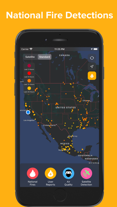
About Firesource - Live Wildfires
The description on the store listing
Firesource’s features:
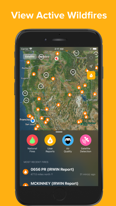
◦ Live fire feed - both on map and in scrollable menu
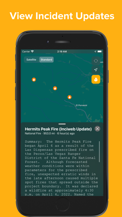
◦ Local and national fire incidents - news updates and reports
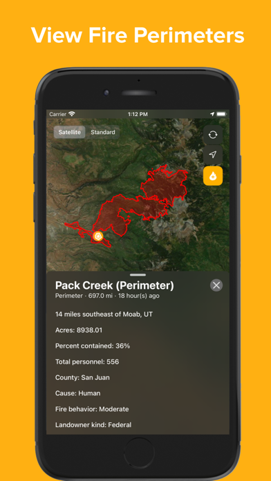
◦ Fire perimeters - access all realtime fire perimeters at once with information about fire growth and progress, including acreage, containment, personnel, fire cause, and fire behavior
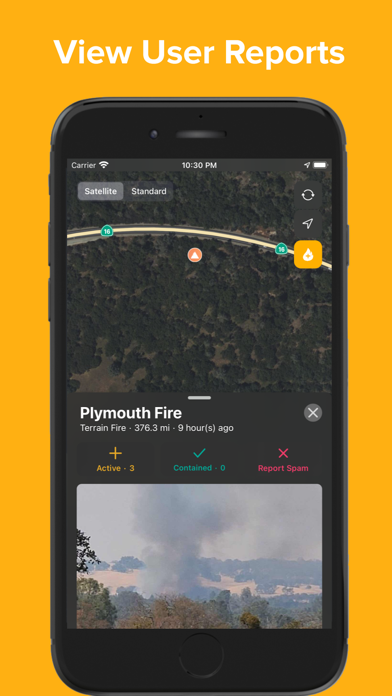
◦ Report a fire - instantly inform other users of a nearby fire by pressing the + button, taking a picture of the fire, and submitting
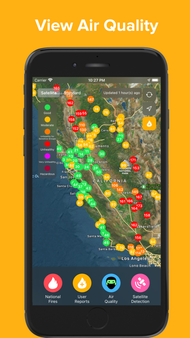
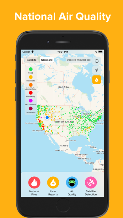
◦ Air quality - see the effects of recent fires by viewing realtime air quality measurements across the country
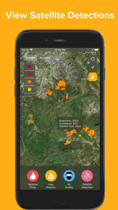
◦ Satellite fire detections can indicate new fires and how current fires are spreading
National Fires (InciWeb, Cal Fire, …
Read the full description
Firesource’s features: ◦ Live fire feed - both on map and in scrollable menu ◦ Local and national fire incidents - news updates and reports ◦ Fire perimeters - access all realtime fire perimeters at once with information about fire growth and progress, including acreage, containment, personnel, fire cause, and fire behavior ◦ Report a fire - instantly inform other users of a nearby fire by pressing the + button, taking a picture of the fire, and submitting ◦ Air quality - see the effects of recent fires by viewing realtime air quality measurements across the country ◦ Satellite fire detections can indicate new fires and how current fires are spreading National Fires (InciWeb, Cal Fire, IRWIN): InciWeb is an interagency incident management system run by the National Wildfire Coordinating Group. InciWeb collects wildfire incident data from several agencies across the United States and provides all of this data together in several feeds. Firesource presents wildfire incidents reported by InciWeb in real time, providing the fire’s location and detailed status. Learn more about InciWeb at their website: https://inciweb.nwcg.gov/. Learn more about Cal Fire, which also provides incident information, at their website: https://www.fire.ca.gov. Learn more about IRWIN, the data hub of fire reports, at https://www.forestsandrangelands.gov/WFIT/applications/IRWIN/. National Fires (Perimeters): Perimeter data is provided by the Wildland Fire Interagency Geospatial Services (WFIGS) Group and hosted in the National Interagency Fire Center ArcGIS Online Organization (The NIFC Org). Firesource displays fire perimeters and descriptions of their progress in the ‘National Fires’ tab of the menu, with this information updated on a regular basis. Learn more about the NIFC at their website: https://www.nifc.gov User-Reported Fires: Allowing app users to report a fire and immediately inform other users is an essential aspect of Firesource. To report a fire, press the yellow + button in the top right corner of the map, select the type of fire (vehicle fire, forest fire, terrain fire, structure fire), take a photo of the fire, and press submit. To ensure the validity of fire reports, the user must take a photo of the fire and cannot access Camera Roll to select a picture. Please note that submitting a fire report automatically creates the report at the user’s location, to further ensure that the fire is local and valid. When viewing user-reported fires in the feed, other users can ‘rate’ the fire report by confirming that it is active, contained, or a spam reporting. Air Quality: Air quality measurements from across the United States are collected from AirNow.gov, which provides national air quality data using the Air Quality Index (AQI). This data is color-coded to provide information about health concerns due to PM2.5 pollutants. Satellite-Detected Fires: Thermal hotspot detections are displayed and collected from NASA’s Moderate Resolution Imaging Spectroradiometer (MODIS), which is an instrument on the Terra and Aqua satellites. Information provided from MODIS about each detection includes brightness (brightness temperature in Kelvin of a fire pixel) and confidence (quality of fire pixel). These fire detections are extremely useful, as they can indicate new fires and fire spread. Learn more about MODIS at their website: https://modis.gsfc.nasa.gov Firesource is not affiliated with any government agencies. Firesource is only available for iPhone and iPad in the United States, Canada, and Australia. Privacy Policy: https://firesourceapp.weebly.com/privacy-policy.html Learn more and contact us at https://firesourceapp.weebly.com/
Installs, last 30 days
Apple does not publish download counts. Estimates are in testing.
Estimated store revenue Estimated Beta
App Store, worldwide, monthly rate from the last 13 chart days to 20 Nov 2026
Below the top 100 grossing apps in the markets we calibrate. In the United States that usually means under about $6.4M a month. App Store purchases and subscriptions only, before Apple's 15 to 30% fee. Ads and web payments are not included.
Ratings
2,658 ratings, 2,658 reviews
No rating breakdown published for this app.
Recent reviews
Latest public reviews from the store
- 18 Jun 2024
I like this app, but…
As a few others have mentioned, a horizontal format would be useful. I’d also like to be able to sort the active fires by distance to my location in addition to the times the fires started. Thanks for all your work on this important app.
- 6 Sep 2022
Thanks to the Developers! This app is a must have for anyone living in a fire area!
Thank you to the developers! I have been waiting for a comprehensive well thought out app for years… I now have one. Watch Duty is the first app that is worth keeping on my phone and using as a critical resource in an emergency. It does not require a fire become large before it shows up on the app. The app is not limited to one Fire agency but reports fires from multiple agencies, jurisdictions and cities. Evacuation site information is not limited to people but includes small and large animals too. (Thank you!) App includes an interactive map, Fire maps and Fire information, pictures and evacuation information. Again Thanks to the Developers! This app is a must have for anyone living in a fire area.
- 30 Apr 2022
Great easy to use tool
App is very easy to use and linkage to external information is excellent
- 29 Aug 2021
Too hard to view fire perimeters
Things I want to know right off the bat: where are the fires, how big is the active/burned area, what direction is it moving, and what’s the air quality. While this app does have perimeter info, it’s too hard to find for each fire and should be displayed on the map by default. But I do really appreciate that the app also has air quality. I always feel like I’m fighting with the bottom menu to stay minimized, it keeps popping up and takes 1/3 of the screen. Even the minimized version of the menu uses a lot of real estate. I doubt I would ever use the feed. This app is promising because most of the information is there, it just needs to be displayed better!
What reviewers bring up
Topics mentioned in the latest 8 reviews, by how many reviews mention them
Liked in good reviews (4 reviews)
- information 2
- tool 2
Raised in bad reviews (2 reviews)
- fire 2
- see 2
Top chart positions
Latest App Store chart ranks by country, last 10 days
- Countries ranked
- 1 of 50
- Best rank
- #83
- Top 10 placements
- 0
- of 1 chart placements
- Average rank
- #83
Best countries on App Store
- 🇦🇺 Australia · Top free, Weather#83
| Country | Chart | Category | Rank | Best (10 days) | Date |
|---|---|---|---|---|---|
| 🇦🇺 Australia | Top free | Weather | #83 | #61 | 18 Nov 2026 |
Firesource - Live Wildfires history
Release, install milestones, listing and store changes
- First released on the store 13 Jun 2020
Update frequency
How often Firesource - Live Wildfires ships a new version, month by month
0 updates in the last 12 months. Less often than most similar apps: they shipped a median of 4 updates in the same year.
Recent versions
Current version 1.2.5
- Version 1.2.511 Apr 2023
- UI/UX improvements - Bug fixes
Listing keywords
Words and phrases Firesource - Live Wildfires repeats most in its store listing
Top phrases: air quality (6), learn more about (5), fire perimeters (3), national fires (3), report fire (3).
Highlighted words also appear in the title. Counts cover the title, short description and description.
Compliance
What the listing and the app package show
- Store status
- Live
- Upkeep
- No update since 11 Apr 2023
- Age rating
- 4+
Apps like Firesource - Live Wildfires
 WIFR WeatherGray Television Group, Inc.★ 4.65
 MoCoSnow AppSolomon Sapiro★ 4.74
 RadarScopeBase Velocity, LLC★ 4.16
 Heat SafetyQvyshift LLC★ 4.65
 Forecast Bar - Weather + RadarHigher Bar, LLC★ 4.51
 My Aurora Forecast ProJRustonApps B.V.★ 4.8
 News13 WBTW Weather RadarLIN Television Corporation★ 4.72
 WRAL WeatherCapitol Broadcasting Company★ 4.07
 Acme WeatherAcme Weather★ 4.71
Firesource - Live Wildfires: questions and answers
Who makes Firesource - Live Wildfires?
Firesource - Live Wildfires is published by Hemal doshi.
When was Firesource - Live Wildfires last updated?
The latest version (1.2.5) was released on 11 Apr 2023.
Is Firesource - Live Wildfires free?
Yes. Firesource - Live Wildfires is free to download.
Is Firesource - Live Wildfires still available?
Yes. Firesource - Live Wildfires is live on App Store as of 20 Nov 2026.
Track Firesource - Live Wildfires and its competitors
Watch any app for new versions, rating drops, chart moves and removals. Free plan, no card.