
- Installs
- —
- Apple does not publish download counts
- Rating
- 4.8
- Ratings
- 22.3K
- 22.3K reviews
- Version
- 5.1.2
- Updated 27 Oct 2026
- Released
- 7 May 2013
- Tracked since 11 May 2026
- Size
- 116 MB
- Needs 17.0
Also on Google Play: Footpath Route Planner (10K ratings)
Screenshots



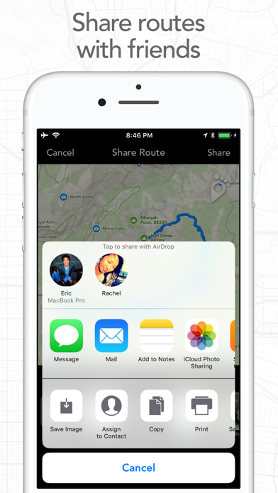
About Footpath Route Planner
The description on the store listing
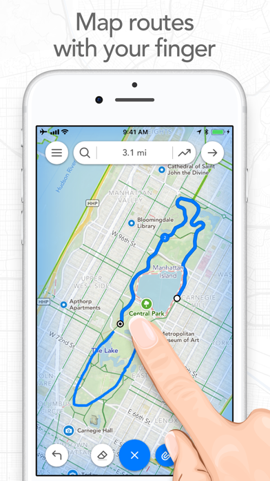
Map routes with your finger and Footpath will snap to roads and trails. Measure distances and elevations in seconds, then navigate along with turn-by-turn directions.
Footpath is the ultimate companion for planning and navigating custom routes.
Join millions of adventurers and plan out your perfect route.
SNAP TO MAP
Quickly measure distances by tracing a map with your finger or Apple Pencil. Footpath will snap to roads and trails on the map.
MEASURE DISTANCE AND ELEVATION
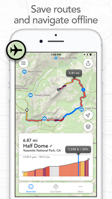
Know exactly how far and how high you'll travel with elevation profiles. Plan routes that match your goals.
SAVE ROUTES FOR LATER
Plan out your week or trip. Keep up to 5 routes on hand for reference, or save …
Read the full description
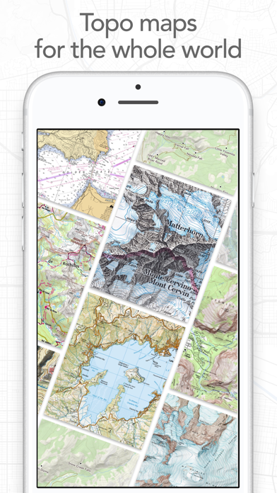
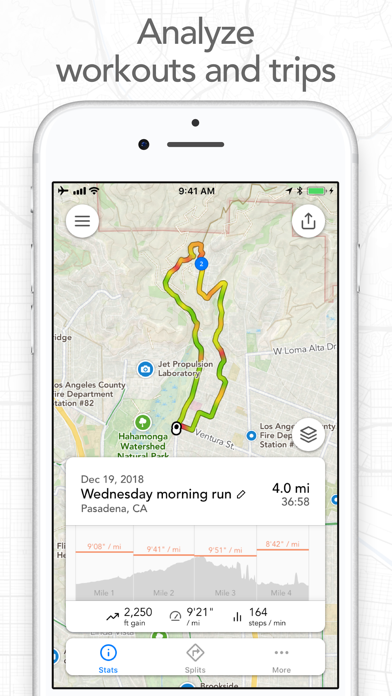
Map routes with your finger and Footpath will snap to roads and trails. Measure distances and elevations in seconds, then navigate along with turn-by-turn directions. Footpath is the ultimate companion for planning and navigating custom routes. Join millions of adventurers and plan out your perfect route. SNAP TO MAP Quickly measure distances by tracing a map with your finger or Apple Pencil. Footpath will snap to roads and trails on the map. MEASURE DISTANCE AND ELEVATION Know exactly how far and how high you'll travel with elevation profiles. Plan routes that match your goals. SAVE ROUTES FOR LATER Plan out your week or trip. Keep up to 5 routes on hand for reference, or save unlimited routes with Footpath Elite. SHARE ROUTES Send your routes to friends or workout partners to open on their device. Footpath is designed to work for pretty much any activity or adventure, in any country: • Running • Cycling and mountain biking • Hiking and mountaineering • Walking • Motorcycling and driving • Backcountry skiing • Kayaking and standup paddleboarding • Sailing • And many more! FOOTPATH ELITE Ready to go the extra mile? Upgrading to Footpath Elite unlocks the following powerful features: TURN-BY-TURN NAVIGATION - Footpath will tell you when to turn with turn-by-turn audio cues on your iPhone and Apple Watch - Save your route and cues in advance for voice guidance that works completely offline - Double tap your AirPods or use the playback controls button on your headphones to replay your next cue PREMIUM OFFLINE MAPS - 3D and topographic maps including Footpath Outdoors (Worldwide), USGS Topo Maps (U.S. and Canada), OpenCycleMap (Worldwide), and many more - Cycling lanes, avalanche slope shading, and elevation contour lines - Download maps for use offline - Save places as favorites to customize your maps ORGANIZE - Create and edit unlimited saved routes - Duplicate, merge, and split routes - Organize and sort routes into custom lists ANALYZE - Record GPS tracks of your activities - Use HealthKit display and log extra health and fitness metrics such as heart rate during a GPS activity - View a calendar log and weekly summary of your activities - Analyze splits, speed, elevation, and heart rate - View a heatmap of your speed during your activity EXPORT - GPX import and export - TCX and FIT course export for turn-by-turn navigation on Garmin and Wahoo GPS devices - Export cue sheets to a spreadsheet app for customization and printing - Export your routes and workouts to Apple Health You can purchase a Footpath Elite monthly or yearly subscription through your iTunes account. Your subscription will automatically renew unless cancelled at least 24 hours before the end of the current period. Auto-renew can be turned off anytime by going to the Manage Subscriptions page in settings after purchase, and your features will remain active until the end of the subscription period. Your account will be charged for renewal within 24-hours prior to the end of the current period at the same cost as your original purchase. TIPS FOR MAPPING ROUTES • For longer routes, try zooming in and mapping your route in multiple segments. • Tap and hold the map to quickly route between waypoints and POIs. • Did Footpath snap to the wrong roads? Trace over the incorrect segment to edit, or use the eraser tool. • Turn off snap to roads (magnet icon) and zoom in to manually trace the map. (Try switching to a satellite layer). • Displaying maps and continuously running GPS in the background can dramatically decrease battery life. Navigate without maps or with the screen off for all day battery life. CONTACT US We've got a lot planned for Footpath. If you have any suggestions or feedback, or if you run into any issues, please contact us at [email protected] Terms of Service: https://footpathapp.com/terms Privacy Policy: https://footpathapp.com/privacy
Installs, last 30 days
Apple does not publish download counts. Estimates are in testing.
Estimated store revenue Estimated Beta
App Store, worldwide, monthly rate from the last 12 chart days to 19 Nov 2026
Below the top 100 grossing apps in the markets we calibrate. In the United States that usually means under about $6.4M a month. App Store purchases and subscriptions only, before Apple's 15 to 30% fee. Ads and web payments are not included.
Ratings
22,311 ratings, 22,311 reviews
- 5 ★87%
- 4 ★9.3%
- 3 ★2.2%
- 2 ★0.6%
- 1 ★1.1%
Recent reviews
Latest public reviews from the store
- 28 Apr 2026
Footpath for the WIN
I do quite a bit of hiking and walking around in the woods sometimes on barely visible trails. Recently I just got back from a multi-day hike in the Gila wilderness with 2 friends. After we kept loosing the trail in an overgrown area and second guessing footpath we quickly learned that our best bet was to follow the footpath trail as close as possible. In all instances I have found footpath to have, by far, the highest accuracy rate, and also ease of use. I have tried a number of free apps, I have paid for Gaia, Strava, used GPS systems. Footpath shines as the clear winner. I am back home in Vermont and just checked it out of curiosity for some trails in my backyard. Many maps I check don’t have them, or have only portions. Footpaths has them perfectly laid out and complete. Not only that but the route making feature is sooooo easy to use and the elevation profile so helpful. Bravo. Footpath for the win.
- 30 May 2025
Work at this; give yourself some time to focus.
I use this infrequently, and therefore, it requires some planning ahead of time… those with whom I bike don’t want to wait for me to waste their time with my OCD influenced methods of planning. That aside, I really enjoy the planning effort, because, especially for those places in which I am unfamiliar or for example, vacation traveling for the first time in our NewMar 4369, I can enjoy the ride while riding, rather than having to pay close attention to where I am in order to avoid getting lost, or having to backtrack over territory that is not enjoyable to me. The information I obtain and/or learn, is fundamentally helpful in the sense that I retain a lot more about the environment and can focus on the pleasureable visual elements. For example, I love trees and can photo trees while riding and then associate the photos with the specific location on the route. I highly recommend recommend this app.
- 2 Sep 2024
Tried them all and this is the one for my bike touring/camping
I have paid for and used about all of them for creating a route and adjusting on the fly but, this is the one. Only this app, not OSM, not Naviki, no Guru Mape, not Here, not Garmin, not Google, not Apple… and probably some others I am forgetting do what this app can do and is what I went through all the other apps looking for. At least in the USA only this app easily allows you to connect dedicated bike paths by simply clicking on the OpenCycleMap where you want to go. When you have to venture away from your planned route its interface makes that effortless. Draw with your finger and it will snap to the road and favor bike friendly. If the app snaps to something that you don’t want, click on the eraser until and draw that segment against. So on the side of the road or trail you can create a new plan in less than a minute. Here is the second best thing. It has unrivaled import and export features. More formats and more options to share.
- 21 Mar 2023
Disappointing
First and foremost, this review is strictly for my use case: I wanted a GPS voice navigation app that would run in the background on my Apple Watch while I use the Stryd app to track my running. Footpath is designed to allow this when setting it to "use with other workout app." However, after testing it out what I've learned is that the two apps don't play well together. First I upload or create my route in Footpath, then I go out for my run. Footpath is supposed to stay in the background, give voice turn by turn directions, and send notifications to my Apple Watch. The voice directions work fairly well, prompting me where to make turns. However, the notifications throw everything off. When the notification is dismissed, it often switches to the Footpath app from the Stryd app. When that happens, Stryd loses access to the GPS data it needs and all of my run data gets screwed up. In short, this app is exactly what I need on paper. In reality, it doesn't work as designed (at least with my configuration). After testing a bit further, I think the two will work together if I turn off notifications on my Watch display from Footpath and just listen to the voice alerts. That's
What reviewers bring up
Topics mentioned in the latest 8 reviews, by how many reviews mention them
Liked in good reviews (4 reviews)
- route 4
- where 3
- footpath 2
- possible 2
- planning 2
- helpful 2
- planned 2
- second 2
Raised in bad reviews (2 reviews)
- turn navigation 2
- terrain 2
- seemed 2
- cannot 2
- water 2
- map 2
Top chart positions
Latest App Store chart ranks by country, last 10 days
- Countries ranked
- 42 of 50
- Best rank
- #13
- Top 10 placements
- 0
- of 60 chart placements
- Average rank
- #70.6
Best countries on App Store
- 🇬🇧 United Kingdom · Top grossing, Navigation#13
- 🇲🇾 Malaysia · Top grossing, Navigation#14
- 🇧🇪 Belgium · Top grossing, Navigation#22
- 🇳🇴 Norway · Top grossing, Navigation#22
- 🇩🇰 Denmark · Top grossing, Navigation#22
- 🇨🇭 Switzerland · Top grossing, Navigation#24
| Country | Chart | Category | Rank | Best (10 days) | Date |
|---|---|---|---|---|---|
| 🇬🇧 United Kingdom | Top grossing | Navigation | #13 | #12 | 19 Nov 2026 |
| 🇲🇾 Malaysia | Top grossing | Navigation | #14 | #14 | 19 Nov 2026 |
| 🇧🇪 Belgium | Top grossing | Navigation | #22 | #17 | 19 Nov 2026 |
| 🇳🇴 Norway | Top grossing | Navigation | #22 | #22 | 19 Nov 2026 |
| 🇩🇰 Denmark | Top grossing | Navigation | #22 | #19 | 19 Nov 2026 |
| 🇨🇭 Switzerland | Top grossing | Navigation | #24 | #20 | 19 Nov 2026 |
| 🇦🇹 Austria | Top grossing | Navigation | #29 | #17 | 19 Nov 2026 |
| 🇳🇱 Netherlands | Top grossing | Navigation | #31 | #15 | 19 Nov 2026 |
| 🇪🇸 Spain | Top grossing | Navigation | #33 | #27 | 19 Nov 2026 |
| 🇫🇷 France | Top grossing | Navigation | #34 | #20 | 19 Nov 2026 |
Footpath Route Planner history
Release, install milestones, listing and store changes
- First released on the store 7 May 2013
Update frequency
How often Footpath Route Planner ships a new version, month by month
5 updates in the last 12 months. About as often as similar apps, which shipped a median of 5 updates in the same year.
Recent versions
Current version 5.1.2
- Version 5.1.127 Oct 2026
NEW WAYS TO SHARE - Overlay animated routes over your photos - Create transparent route stickers to overlay over Instagram Stories - Share animated map videos of your route - Friends can scan a QR code to open your route right on their phone 3D FLYOVER PREVIEWS (ELITE) You can now preview your route or replay a recorded activity with cinematic 3D flyover videos OTHER IMPROVEMENTS - Full support for the new iPhone Duo - You can now fine tune your estimated duration and set a start time for predicted ETAs (ELITE) - Fixes issue where Garmin Connect wouldn't save a GPX export from Footpath - Bug fixes Leave us an App Store review if you're enjoying Footpath, or feel free to contact us at [email protected] with any problems or suggestions.
- Version 4.11.25 Aug 2026
- Fixed an issue with elevations in GPX exports - Bug fixes Leave us an App Store review if you're enjoying Footpath, or feel free to contact us at [email protected] with any problems or suggestions.
- Version 4.11.14 Aug 2026
- Fixed an issue with elevations in GPX exports - Bug fixes Leave us an App Store review if you're enjoying Footpath, or feel free to contact us at [email protected] with any problems or suggestions.
- Version 4.1123 Jul 2026
- Improved map rendering on Apple Watch, added road and trail labels when panning the map - Fixed an issue where subscriptions would fail to refresh if cellular Low Data Mode was enabled - Fixed an issue dragging to reorder routes in a list on iOS 26 - Fixed an issue loading images in Wikipedia articles - Bug fixes Leave us an App Store review if you're enjoying Footpath, or feel free to contact us at [email protected] with any problems or suggestions.
Listing keywords
Words and phrases Footpath Route Planner repeats most in its store listing
Top phrases: turn by turn (4), footpath elite (4), snap to roads (3), footpath will snap (2), roads and trails (2).
Highlighted words also appear in the title. Counts cover the title, short description and description.
Compliance
What the listing and the app package show
- Store status
- Live
- Upkeep
- Updated 27 Oct 2026
- Age rating
- 4+
Apps like Footpath Route Planner
 Bolt Driver: Drive & EarnBOLT TECHNOLOGY OU★ 4.68
 Drive SmarterCEDAR ELECTRONICS HOLDINGS CORP.★ 4.77
 Qibla Finder 100% اتجاه القبلةCNT INTERAKTIF BILGI TEKNOLOJILERI YAZILIM SANAYI VE TICARET ANONIM SIRKETI★ 4.66
 iNavX: Marine NavigationNavX Studios LLC★ 4.76
 Spoten Phone Location TrackerSUPERSSTAR LABS, SOCIEDAD LIMITADA★ 4.28
 ValeroPay+Valero Marketing and Supply Company★ 4.8
 Parking.com - Find Parking NowMetropolis Technologies, Inc.★ 4.49
 Qibla Finder, Qibla Compass ARBEKART TECH BILISIM TEKNOLOJI INSAAT TICARET LIMITED SIRKETI★ 4.76
 ProximiT: MBTA Boston TransitJeff Lopes★ 4.61
Footpath Route Planner: questions and answers
Who makes Footpath Route Planner?
Footpath Route Planner is published by Half Mile Labs LLC.
When was Footpath Route Planner last updated?
The latest version (5.1.2) was released on 27 Oct 2026.
Is Footpath Route Planner free?
Yes. Footpath Route Planner is free to download.
Is Footpath Route Planner still available?
Yes. Footpath Route Planner is live on App Store as of 19 Nov 2026.
Track Footpath Route Planner and its competitors
Watch any app for new versions, rating drops, chart moves and removals. Free plan, no card.