
- Installs
- —
- Apple does not publish download counts
- Rating
- 4.08
- Ratings
- 12
- 12 reviews
- Version
- 3.31
- Updated 19 Nov 2019
- Released
- 5 Aug 2011
- Tracked since 10 May 2026
- Size
- 44 MB
- Needs 9.0
Screenshots
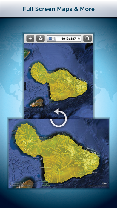
About GIS Kit
The description on the store listing
Premier field collection and data viewer for iPhone and iPad.
- No desktop GIS software required.
- No prior GIS training required.
- Completely offline capable.
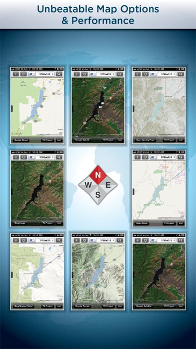
- Cache (download) open source topographic maps, street maps and satellite imagery straight from device.
- Import ESRI Shapefiles and KML/KMZ files including attributes.
- Attribute fields include: Alphanumeric (Description), Photos, numerical values, user defined list of values, addresses, websites, date & time, telephone number, check box.
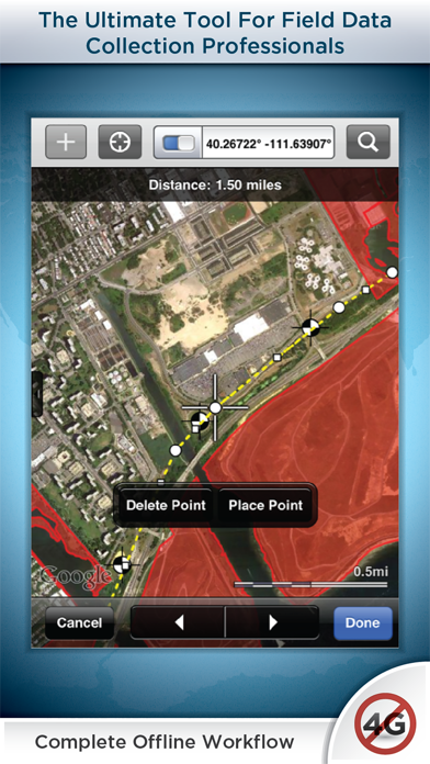
- Easily collect new point, line, and polygon features in the field by GPS or drawing manually.
- Enter attribute values for each feature and/or add new attribute types at time of …
Read the full description
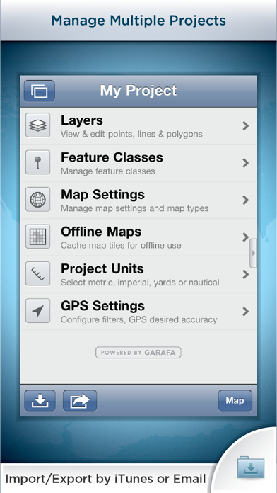
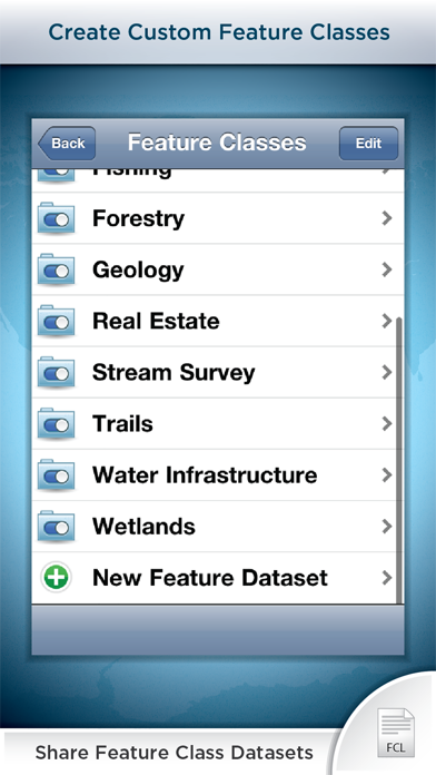
Premier field collection and data viewer for iPhone and iPad. - No desktop GIS software required. - No prior GIS training required. - Completely offline capable. - Cache (download) open source topographic maps, street maps and satellite imagery straight from device. - Import ESRI Shapefiles and KML/KMZ files including attributes. - Attribute fields include: Alphanumeric (Description), Photos, numerical values, user defined list of values, addresses, websites, date & time, telephone number, check box. - Easily collect new point, line, and polygon features in the field by GPS or drawing manually. - Enter attribute values for each feature and/or add new attribute types at time of collection. - Create templates of user defined feature classes with custom attributes. - Comes loaded with numerous example feature templates for professional use in Forestry, Wetland Delineation, Stream Surveys, and Real Estate. - Import and export data wirelessly by email. Larger data sets can be imported/exported by connecting to any computer with itunes. - Organize by projects and layers - Best-in-class performance. Check our website to see videos, documentation and more information about the "Pro" version. Please note that all the features of the GIS Pro version (such as Shapefile export) are available through in-app purchase in this app as well. For Businesses: Please note that a separate license is required for each user or each device that is used by multiple users. See http://www.apple.com/legal/itunes/us/terms.html for details. Also see http://www.apple.com/business/vpp for information on purchasing in volume. Continued use of GPS running in the background can dramatically decrease battery life.
Installs
Apple does not publish download counts. Estimates are in testing.
We publish iOS estimates only after they pass a back-test against real numbers. Chart history below is measured.
Estimated store revenue Estimated Beta
App Store, worldwide, monthly rate from the last 12 chart days to 19 Nov 2026
Below the top 100 grossing apps in the markets we calibrate. In the United States that usually means under about $6.4M a month. App Store purchases and subscriptions only, before Apple's 15 to 30% fee. Ads and web payments are not included.
Ratings
12 ratings, 12 reviews
No rating breakdown published for this app.
Recent reviews
Latest public reviews from the store
No reviews in our sample for this app yet.
Top chart positions
Latest App Store chart ranks by country, last 10 days
- Countries ranked
- 4 of 50
- Best rank
- #47
- Top 10 placements
- 0
- of 5 chart placements
- Average rank
- #68.4
Best countries on App Store
- 🇨🇦 Canada · Top grossing, Navigation#47
- 🇨🇴 Colombia · Top paid, Navigation#51
- 🇵🇪 Peru · Top paid, Navigation#76
- 🇨🇱 Chile · Top paid, Navigation#95
| Country | Chart | Category | Rank | Best (10 days) | Date |
|---|---|---|---|---|---|
| 🇨🇦 Canada | Top grossing | Navigation | #47 | #47 | 11 Nov 2026 |
| 🇨🇴 Colombia | Top paid | Navigation | #51 | #50 | 19 Nov 2026 |
| 🇨🇦 Canada | Top paid | Navigation | #73 | #7 | 19 Nov 2026 |
| 🇵🇪 Peru | Top paid | Navigation | #76 | #75 | 19 Nov 2026 |
| 🇨🇱 Chile | Top paid | Navigation | #95 | #94 | 17 Nov 2026 |
GIS Kit history
Release, install milestones, listing and store changes
- First released on the store 5 Aug 2011
Update frequency
How often GIS Kit ships a new version, month by month
0 updates in the last 12 months. Less often than most similar apps: they shipped a median of 1 updates in the same year.
Recent versions
Current version 3.31
- Version 3.3119 Nov 2019
Bug fixes and optimizations.
Listing keywords
Words and phrases GIS Kit repeats most in its store listing
Top phrases: please note (2), pro version (2), user defined (2).
Highlighted words also appear in the title. Counts cover the title, short description and description.
Compliance
What the listing and the app package show
- Store status
- Live
- Upkeep
- No update since 19 Nov 2019
- Age rating
- 4+
Apps like GIS Kit
 Canals.UKMARK MANSER★ 4.74
 Chevron Car WashDigital Mosaic Corporation★ 1.62
 hitta.sehittapunktse AB★ 4.6
 NextStop - NYC SubwayPliable Matter LLC★ 3.74
 E-Charge HKHong Kong EV Power Limited★ 4.34
 Simply NorthBusyBytes GmbH★ 4.08
 Doyle GuidesChris Doyle Publishing Limited★ 4.32
 Speedometer Speed MPH TrackerRihab Mehboob★ 4.62
 Property Line Finder - ParcelHealth & Wellness Apps Limited★ 4.28
GIS Kit: questions and answers
Who makes GIS Kit?
GIS Kit is published by Garafa, LLC.
When was GIS Kit last updated?
The latest version (3.31) was released on 19 Nov 2019.
Is GIS Kit free?
No. GIS Kit is a paid app priced at $99.99.
Is GIS Kit still available?
Yes. GIS Kit is live on App Store as of 1 Jul 2026.
Track GIS Kit and its competitors
Watch any app for new versions, rating drops, chart moves and removals. Free plan, no card.