
- Installs
- —
- Apple does not publish download counts
- Rating
- 4.46
- Ratings
- 194
- 194 reviews
- Version
- 3.3.0
- Updated 1 Oct 2026
- Released
- 11 May 2022
- Tracked since 10 May 2026
- Size
- 157 MB
- Needs 14
Screenshots
About GoGoEarth - Custom map source
The description on the store listing
Many people have dreamed of traveling the world and choose to bury their dreams for a variety of reasons. Come and visit the Globe Earth~
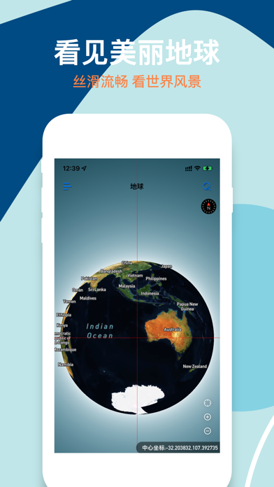
Globe Earth allows you to hold a magical globe, which is as smooth and small as a globe, and as real and clear as our earth.
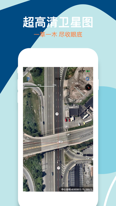
Globe Earth provides map zoom levels 0-22, using de-cloud data from NASA MODIS satellites at zoom levels 0-8.
Maxar satellite imagery and NASA/USGS Landsat 5 and 7 imagery are mainly used in limited locations at zoom levels 9-12.
Use a combination of open and proprietary sources at zoom level 13+, including Maxar's Vivid product for most of the world, Nearmap aerial imagery of US cities, and open aerial imagery from Denmark, …
Read the full description
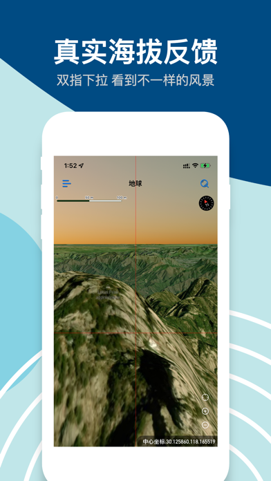
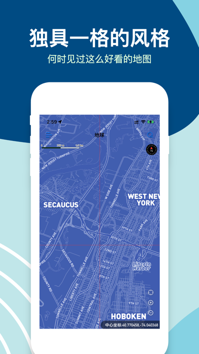
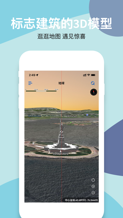
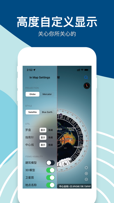
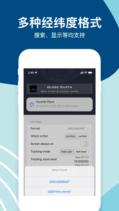
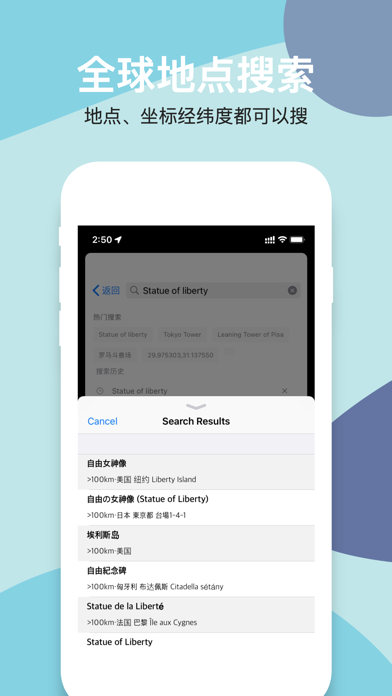
Many people have dreamed of traveling the world and choose to bury their dreams for a variety of reasons. Come and visit the Globe Earth~ Globe Earth allows you to hold a magical globe, which is as smooth and small as a globe, and as real and clear as our earth. Globe Earth provides map zoom levels 0-22, using de-cloud data from NASA MODIS satellites at zoom levels 0-8. Maxar satellite imagery and NASA/USGS Landsat 5 and 7 imagery are mainly used in limited locations at zoom levels 9-12. Use a combination of open and proprietary sources at zoom level 13+, including Maxar's Vivid product for most of the world, Nearmap aerial imagery of US cities, and open aerial imagery from Denmark, France, Germany, and elsewhere. Globe Earth satellite images come from a variety of sources, and the original images are color corrected to look realistic. In addition to ultra-high-definition satellite images, we also provide other easy-to-use features: - Search: Search anywhere in the world at will - World Street View: HD panoramic street view maps of more than 200 countries and regions around the world - Classic building models: For some scenic spots, we provide 3D models based on real buildings, look for them~ - Map style switching: Tired of satellite images? There are other styles for you to switch, and we will provide more styles in the future - Navigation: Although this is not our main purpose, we still provide a complete basic navigation function for the convenience of users. - Real altitude: When you are in satellite image mode, pull down with two fingers to switch the camera from the sky to the ground. During the sliding process, the altitude will be reflected in the map in real time, try it out~ - Supports multiple latitude and longitude formats: copied a latitude and longitude from somewhere else? Feel free to paste in the search bar and we'll automatically recognize the different formats and show you the point. - Favorite places: During your browsing process, if you come across an interesting place that you like, long press to save it, and you can view and go to it at any time in the future. - A variety of custom settings: We provide a lot of custom content, you can set them according to your situation. The surprises that Globe Earth brings to you may not only stop there, but there may also be shortcomings. Users are welcome to give us feedback in a timely manner. Any suggestions can be sent to [email protected]. 【Automatic subscription service description】 1. Subscription and price: a) One-month Pro: A one-month Pro version of Globe Earth, $3.99/month b) One-year Pro: A one-year Pro version of Globe Earth, $9.99 per year, including a three-day free trial 2. Payment: after the user confirms the purchase and pays, the payment is credited to the iTunes account 3. Automatic Renewal: Apple's iTunes account withdraws a fee 24 hours before it expires, and the subscription cycle is extended by one time. 4. Turn off the service: you can manage automatic subscriptions from your iphone's settings-> iTunes Store and App Store-> Apple ID-> view Apple ID-> account settings-> subscriptions. If you want to cancel, each billing cycle can be closed 24 hours before the end of the 24 hours before the expiration of the non-deduction. Terms of Use:https://pages.flycricket.io/globe-earth/terms.html Privacy Policy:https://pages.flycricket.io/globe-earth/privacy.html
Installs since 29 Aug 2026
Apple does not publish download counts. Estimates are in testing.
Estimated store revenue Estimated Beta
App Store, worldwide, monthly rate from the last 13 chart days to 20 Nov 2026
Below the top 100 grossing apps in the markets we calibrate. In the United States that usually means under about $6.4M a month. App Store purchases and subscriptions only, before Apple's 15 to 30% fee. Ads and web payments are not included.
Ratings
194 ratings, 194 reviews
No rating breakdown published for this app.
Recent reviews
Latest public reviews from the store
- 25 Jul 2024
真棒
我用过的最好的
- 12 Dec 2023
希望添加一个地点名称的文字切换功能
地图上中文和当地的地点文字混看起来有些乱
Top chart positions
Latest App Store chart ranks by country, last 10 days
- Countries ranked
- 2 of 50
- Best rank
- #54
- Top 10 placements
- 0
- of 2 chart placements
- Average rank
- #69
Best countries on App Store
- 🇨🇳 China · Top grossing, Navigation#54
- 🇲🇽 Mexico · Top grossing, Navigation#84
| Country | Chart | Category | Rank | Best (10 days) | Date |
|---|---|---|---|---|---|
| 🇨🇳 China | Top grossing | Navigation | #54 | #54 | 20 Nov 2026 |
| 🇲🇽 Mexico | Top grossing | Navigation | #84 | #84 | 14 Nov 2026 |
GoGoEarth - Custom map source history
Release, install milestones, listing and store changes
- First released on the store 11 May 2022
Update frequency
How often GoGoEarth - Custom map source ships a new version, month by month
3 updates in the last 12 months. More often than most similar apps: they shipped a median of 1 updates in the same year.
Recent versions
Current version 3.3.0
- Version 3.2.71 Oct 2026
1.We have created a brand new, cool welcome page to help users better understand our product. 2.Bug fixes.
- Version 3.2.617 Aug 2026
- New measurement function added - New offline map function has been added
- Version 3.2.58 Mar 2026
1.Bug fix.
Listing keywords
Words and phrases GoGoEarth - Custom map source repeats most in its store listing
Top phrases: globe earth (7), hours before (3), satellite images (3), zoom levels (3), earth globe earth (2).
Highlighted words also appear in the title. Counts cover the title, short description and description.
Compliance
What the listing and the app package show
- Store status
- Live
- Upkeep
- Updated 1 Oct 2026
- Age rating
- 4+
Apps like GoGoEarth - Custom map source
 Miami Bus Tracker - MDT婧嘉 郭★ 4.78
 NEXITNexit★ 4.48
 Montana TravelerJohn Stump★ 4.41
 Grid Ref UTMMike Irving★ 4.54
 Natural Atlas: Topo Maps & GPSNatural Atlas★ 4.53
 Terrier TransitBoston University★ 2.77
 WingX®Hilton Software LLC★ 3.56
 Tokyo Travel Guide .Maria Monti★ 4.73
 Cell Tower Locator 5G FinderAlena Zaharova★ 4.18
GoGoEarth - Custom map source: questions and answers
Who makes GoGoEarth - Custom map source?
GoGoEarth - Custom map source is published by 大靖 刘.
When was GoGoEarth - Custom map source last updated?
The latest version (3.3.0) was released on 1 Oct 2026.
Is GoGoEarth - Custom map source free?
Yes. GoGoEarth - Custom map source is free to download.
Is GoGoEarth - Custom map source still available?
Yes. GoGoEarth - Custom map source is live on App Store as of 14 Nov 2026.
Track GoGoEarth - Custom map source and its competitors
Watch any app for new versions, rating drops, chart moves and removals. Free plan, no card.