
- Installs
- —
- Apple does not publish download counts
- Rating
- 4.73
- Ratings
- 366
- 366 reviews
- Version
- 14.1.40
- Updated 28 Oct 2026
- Released
- 18 Oct 2013
- Tracked since 11 May 2026
- Size
- 93 MB
- Needs 13.0
Also on Google Play: iFly EFB (731 ratings)
Screenshots


About iFly EFB
The description on the store listing
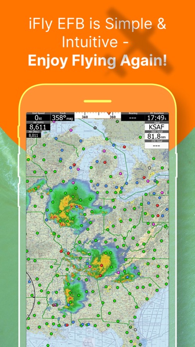
iFly EFB delivers the perfect combination of affordability, capability, and usability for both VFR and IFR Pilots. Safely and quickly get the information you need so you can focus on flying!
Key reasons to try iFly EFB:
1) Ease of use in the cockpit: Our intuitive and simple interface, easy to hit buttons, simple map gestures, large fonts, and more make this the best EFB for in-flight use
2) Pilot focused company: We have staff (pilots) on the ground at our office in Texas waiting to answer your questions. Call 214-585-0444 or email [email protected], we're here to help
3) Price: We are one of the most competitively priced EFBs on the market
4) Capabilities: We are one of …
Read the full description
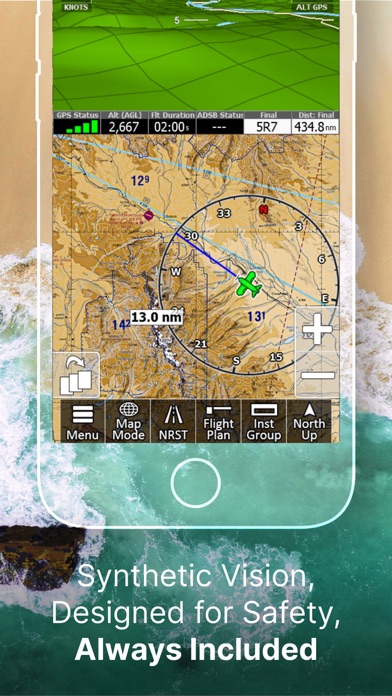
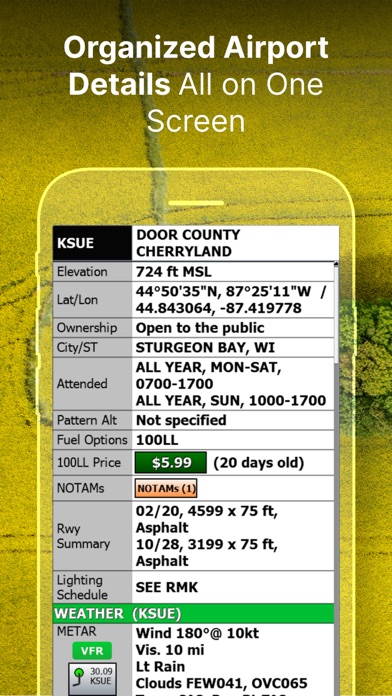
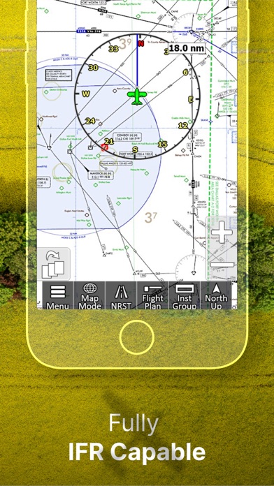
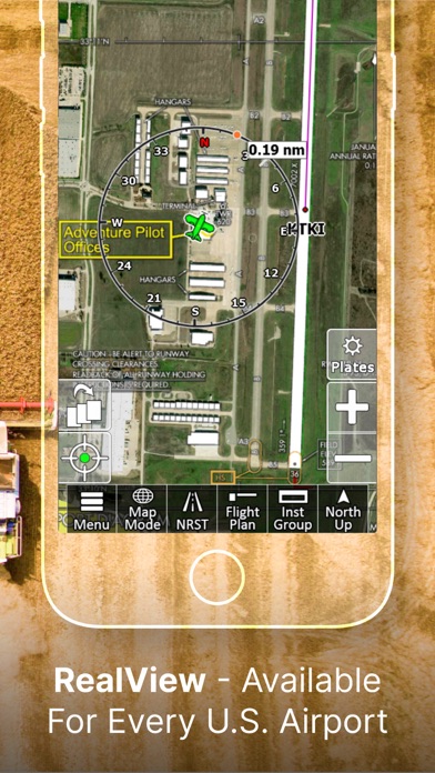
iFly EFB delivers the perfect combination of affordability, capability, and usability for both VFR and IFR Pilots. Safely and quickly get the information you need so you can focus on flying! Key reasons to try iFly EFB: 1) Ease of use in the cockpit: Our intuitive and simple interface, easy to hit buttons, simple map gestures, large fonts, and more make this the best EFB for in-flight use 2) Pilot focused company: We have staff (pilots) on the ground at our office in Texas waiting to answer your questions. Call 214-585-0444 or email [email protected], we're here to help 3) Price: We are one of the most competitively priced EFBs on the market 4) Capabilities: We are one of the most capable EFBs on the market! Need proof? Visit www.iFlyEFB.com/Compare Following are some of our features and benefits: •Geo-Reference Approach Plates and Airport Diagrams •3D Synthetic Vision / EFIS Mode •Terrain, Obstructions, Traffic, and Airspaces Alerts •Complete ADSB support •AutoTaxi+ for safe taxing at any airport •RealView airport imagery •RealPlan automatic VFR Planner •Auto-load approach into plan •Complete VFR and IFR databases and charts (FAA) •Sectionals •Customizable Instruments •Public & Private Airports •Winds aloft including forecasts for 36 hours •Hi/Lo-Enroute Charts •Terminal Area Charts(TAC) •World Aeronautical Charts(WAC) •Vector Mode •Weather (Pre-Flight or ADS-B Live) •Hi-res Winds Aloft Optimizing •Rapid Flight planning •Plates & Diagrams (Approach, Departure Plates, Stars, SIDs Airport Diagrams) •Instruments Panel •Day/Night Mode •Online Flight Plan Filing •Custom Instrument Layouts (24 Instruments, e.g. HSI, Vertical Profile, and AHRS) •Vertical Terrain planning and Airspace preview •Find Nearest •History •North Up / Track Up •Pinch Zooming w/ One Touch Feature •Dynamic Distance Ring •Hybrid Compass Rose w/ Nav Function •Extended Course Line •Flight Trails •Past Flights •Rubber Band route modification •Custom Aircraft icons •AutoTaxi+ •Alerts & Warnings •Button Fading (maximizes screen space) •Custom User Waypoints •Customizable Instruments •Simulator Mode
Installs since 29 Aug 2026
Apple does not publish download counts. Estimates are in testing.
Estimated store revenue Estimated Beta
App Store, worldwide, monthly rate from the last 12 chart days to 19 Nov 2026
Below the top 100 grossing apps in the markets we calibrate. In the United States that usually means under about $6.4M a month. App Store purchases and subscriptions only, before Apple's 15 to 30% fee. Ads and web payments are not included.
Ratings
366 ratings, 366 reviews
No rating breakdown published for this app.
Recent reviews
Latest public reviews from the store
- 9 Dec 2025
Full Featured Easy to Use
Probably one of the least expensive electronic flight bag tools that provides features others charge double for. And, if you want to know something, or need a little help, you just pick up the phone and talk to the team who are supporting it. The company spend time with users and pilots all over the country - from EAA Chapter meetings, pancake breakfasts, or Oshkosh. No other application or development team provides this level of interest or direct support at such an affordable price.
- 21 Sep 2025
Custom waypoints
Over the last several years ,I have flown all the lower 48 states. During these flights ,we added custom waypoints . They give us at a glance , restroom stops , fuel stops ( we use Mo-gas, and that is hard to find in some areas ) . We also have courtesy cars and hotels. Now when we plan a flight , we can quickly plan stops. We love this app! It is intuitive and fast. Our negatives on the app is that it doesn’t, give mo-gas locations, and the FBO info all needs updated. we have found more times than not , it to be inaccurate. So we land and then create custom waypoints info. Foreflight has better FBO information,but it costs too much and is more distracting to use in flight. This app could use a pilot entered fuel update tab , like Waze has, to enter current fuel options and prices at each stop.
- 14 Sep 2025
Best Flying Software on the iPad
I have been using the "other" flying software for decades, in a jet, in smooth air, with the autopilot on. When I park the jet and hand fly my Swift, I use iFly EFB. iFly EFB is amazingly intuitive. It works the way you would expect it to work. It makes planning GA flights simple. Its greatest strength, where it excels over the others, is how usable it is the cockpit. No straining to see tiny text or use small buttons. It simply is easy to use even on the bumpiest flight. I have been flying with iFly EFB for ten years in my Swift. I wish I could take it to work in the jet they pay me to fly.
- 3 Aug 2022
Very Intuitive and Runs Well Even on Old Hardware
I’ve been using this as a trial for about a month. I’m a student pilot and I’ve been using it in my flights. I’ve tried the following moving map GPS apps: Foreflight, FlyQ, Garmin Pilot, Airmate, and Wing X. Out of all of these iFlyGPS has been my favorite for several reasons. First, the layout and design of the app just makes sense to me. Everything is where I expect it to be and behaves the way I think it should. This alone is a huge selling point to me. Another thing that impresses me is that it runs well even on my old iPad Air 2. The other apps either aren’t supported or the old iPad cannot handle them. Something about how iFlyGPS’s design is just very efficient. Finally the app is very inexpensive and I see them running deals fairly often. I see they are designing a new system called iFlyEFB and they say if you pay for one you will get both. That’s nice as well. My only negative points for this app is that the buttons look like they are from Windows 3 and when scrolling around the app the terrain has to load in, however it is very quick. Neither of these points matter to me very much and I think I will buy this software over the others I have used. This is defin
What reviewers bring up
Topics mentioned in the latest 8 reviews, by how many reviews mention them
Liked in good reviews (8 reviews)
- intuitive 5
- others 5
- pilot 5
- flights 4
- where 4
- ipad 4
- ifly 4
- gps 4
Raised in bad reviews (0 reviews)
No topic comes up twice.
Top chart positions
Latest App Store chart ranks by country, last 10 days
Not in any tracked top chart in the last 10 days.
iFly EFB history
Release, install milestones, listing and store changes
- First released on the store 18 Oct 2013
Update frequency
How often iFly EFB ships a new version, month by month
3 updates in the last 12 months. More often than most similar apps: they shipped a median of 1 updates in the same year.
Recent versions
Current version 14.1.40
- Version 14.1.4028 Oct 2026
• Traffic fix: a nearby aircraft no longer disappears from the map while it is still transmitting. • Satellite: prepared for high-resolution imagery delivered through iFly's own secure service. No change in how the map looks or works.
- Version 14.1.2624 Jul 2026
The 14.1 update adds several new features and refinements across the app. NEW • Visual Approaches: set up a visual approach to your landing runway — iFly draws the approach path plus runway and landing route lines to line you up on final. • Mini Checklist Pane: a slide-up pane that keeps your active checklist over the map, auto-collapsing finished sections and opening the next. • Printable NavLog (PDF): generate a leg-by-leg navigation log and print or share it as a PDF. Plus a new Fly-Over planning option and anonymous flight plan filing. • Approach Altitude callouts, with an on/off toggle and threshold policy. • Traffic "Dangerous" (±1500) clearance threshold. • MOS weather guidance alongside METAR/TAF/Winds/PIREP. • Vertical & Horizontal Path instruments that show your deviation from the planned path. • Temporary tower NOTAMs on the Airport view. • Plain-language wind shear/shift decoding, and METAR temperature in Fahrenheit. • Custom Waypoint export, and Generic ADS-B weather-uplink support for more receivers. IMPROVED • Traffic awareness: clearer labels, relative-altitude quick info, and safeguards so dangerous traffic always alerts visually and audibly. • Faster, more reliable alerts and audio callouts. • Data Update ("Check For Updates"): cleaner, larger map, faster area selection, and no more shutdowns for a license check mid-update. • TFRs now show all altitude bands, and "Nearest ATC" includes low-altitude frequencies. • Clearer object search; the "Altitudes" form now shows each airport code. • Night Mode now persists across restarts. FIXED • Improved overall stability and reduced memory use. • Fixed display orientation and scaling. • You can now keep flying with corrupted or missing data files while offline, instead of being locked out. • Plus miscellaneous bug fixes. Thank you for flying with iFly EFB!
- Version 14.0.6416 Apr 2026
Patch Release to 14.0.63 - to fix some a few critical but narrow scoped bugs. Release notes for 14.0.63: 1. Satellite Imagery Layer View high-resolution satellite imagery right on the map. Includes smart caching to help manage disk space, plus the ability to pre-load imagery along your flight plan route. 2. Sharper Display Throughout Graphics, map tiles, terrain elevations, and EFIS 3D now display at approximately double the previous resolution, making the entire app look sharper and clearer. 3. New PDF Viewer for Briefings Flight Plan Briefings now open in a built-in PDF viewer, with a Share option that makes it easy to send briefings by email or through other apps. 4. New Planning Charts WAC charts have been replaced with new Planning Charts, making it easier to view and plan VFR flights at wider map ranges. 5. Flyway Charts Now Available Flyway Charts are now included. 6. Audio Callouts for All Alert Types All alert types can now provide spoken callouts. Individual callouts can be managed under Menu > Settings > Alerts/Warnings > Audio Callouts. 7. NEXRAD Auto-Animation Radar imagery now auto-animates by default for both internet and ADS-B sources. If you turn it off, your preference will be remembered. 8. Native Keyboard Support Platform-specific keyboards are now enabled by default for a more natural typing experience. This can be adjusted under Menu > Setup > Screen. 9. Updated Graphics Engine The app now uses the latest graphics engine for improved performance and compatibility. 10. Flight Plan Improvements - Flight Plan Briefings can now be shared by email or other apps - Improved support for filing flight plans more than 24 hours in advance - Filing now works with Lat/Lon waypoints that do not include airport codes - Fixes for departure time and altitude planning - Your account name now defaults to your registered iFly email address 11. Extended Runway Enhancements The Extend Runways option now also includes departure extensions. 12. Bug Fixes and Stability Improvements - Corrected AIRMET/SIGMET and TFR description text issues - Fixed map coverage for the Caribbean, Puerto Rico, and the Virgin Islands - Improved visibility of the Glide Ring, TOC/TOD markers, and Traffic Radar - Fixed forecast color legend and various alert issues - Corrected raster map tile rendering and track-up behavior - Improved Vector Mode Terrain loading performance
Listing keywords
Words and phrases iFly EFB repeats most in its store listing
Top phrases: ifly efb (3), vfr and ifr (2), airport diagrams (2), customizable instruments (2), winds aloft (2).
Highlighted words also appear in the title. Counts cover the title, short description and description.
Compliance
What the listing and the app package show
- Store status
- Live
- Upkeep
- Updated 28 Oct 2026
- Age rating
- 4+
Apps like iFly EFB
 3D Earth Map Street ViewNaik Ur Rehman★ 4.64
 GPS Tools® - Find,Track & TrekVirtualMaze★ 4.59
 Field Area MeasureYaroslav Babenko★ 4.33
 ADOT 511 Traffic CamerasLW Brands, LLC★ 4.64
 GPS Navigation - Live TrafficAkhil Dholariya★ 4.53
 Truck Parking ClubTruckparkingclub.com, LLC★ 4.55
 RouteHistoryKazuhiko Oda★ 4.75
 fDeck: flight instrumentsDarren Yeates★ 4.79
 Satellite Map - Live Earth慧敏 赵★ 2.81
iFly EFB: questions and answers
Who makes iFly EFB?
iFly EFB is published by Adventure Pilot, LLC.
When was iFly EFB last updated?
The latest version (14.1.40) was released on 28 Oct 2026.
Is iFly EFB free?
Yes. iFly EFB is free to download.
Is iFly EFB still available?
Yes. iFly EFB is live on App Store as of 14 Nov 2026.
Track iFly EFB and its competitors
Watch any app for new versions, rating drops, chart moves and removals. Free plan, no card.