
- Installs
- —
- Apple does not publish download counts
- Rating
- —
- Ratings
- —
- Version
- 2.0
- Updated 27 May 2018
- Released
- 23 Mar 2016
- Tracked since 10 May 2026
- Size
- 120 MB
- Needs 9.0
Screenshots
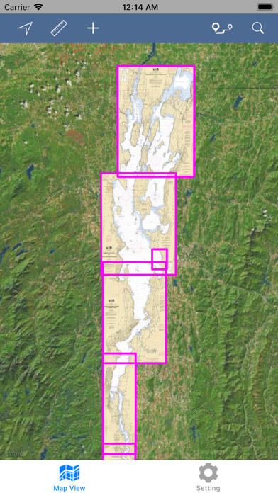
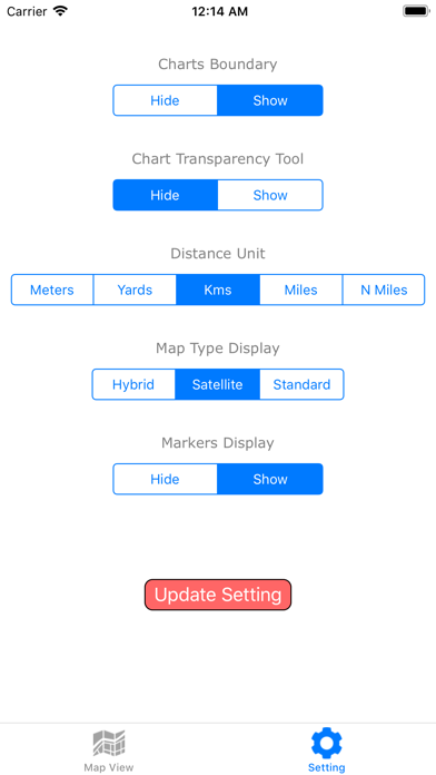
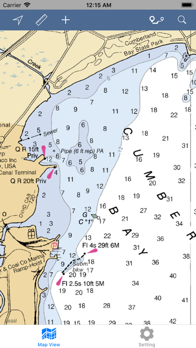
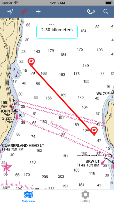
About Lake Champlain – Boating Map
The description on the store listing
THE ALL NEW ADVANCED MARINE RASTER NAUTICAL CHARTS APP FOR BOATERS, ANGLERS, KAYAKERS, CANOERS, FISHERMEN, WATER NAVIGATORS AND SAILORS!
IPHONE, IPHONE X & IPAD PRO COMPATIBLE!
NO WAITING TIME FOR NAUTICAL CHART DOWNLOADS. IT'S READY TO USE!
COMBINATION OF SMALL CRAFT AND HARBOR CHARTS FOR EASY NAVIGATION.
ALL CHARTS OVERLAY IS ARRANGED IN A SEAMLESS ORDER, BASED ON CHART SCALE AND PRIORITY.
NO NEED TO CHANGE CHARTS MANUALLY, THEY ARE READY FOR CONTINUOUS NAVIGATION.
CHART FEATURES:
ALL MARINE RASTER NAUTICAL CHARTS ARE FROM NOAA SOURCES.
ALL CHARTS ALIGNED WITH ORIGINAL CHART CO-ORDINATES, ARE ACCURATE FOR USE.
NEW MAPS FOR OFFLINE CHART OVERLAY DISPLAY, USE THEM AS LONG AS YOU …
Read the full description
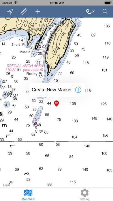
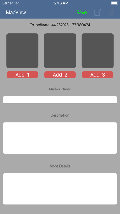
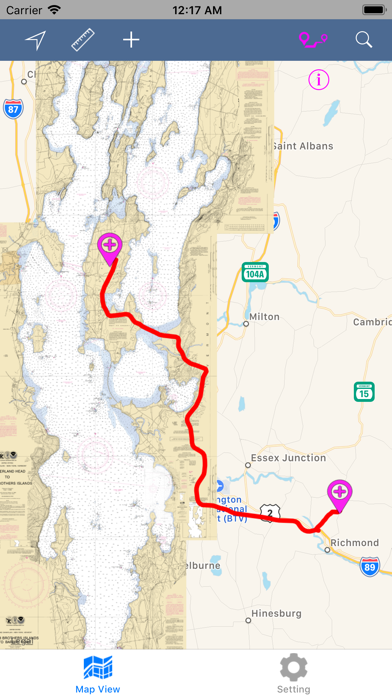
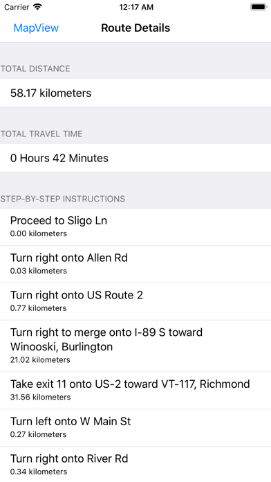
THE ALL NEW ADVANCED MARINE RASTER NAUTICAL CHARTS APP FOR BOATERS, ANGLERS, KAYAKERS, CANOERS, FISHERMEN, WATER NAVIGATORS AND SAILORS! IPHONE, IPHONE X & IPAD PRO COMPATIBLE! NO WAITING TIME FOR NAUTICAL CHART DOWNLOADS. IT'S READY TO USE! COMBINATION OF SMALL CRAFT AND HARBOR CHARTS FOR EASY NAVIGATION. ALL CHARTS OVERLAY IS ARRANGED IN A SEAMLESS ORDER, BASED ON CHART SCALE AND PRIORITY. NO NEED TO CHANGE CHARTS MANUALLY, THEY ARE READY FOR CONTINUOUS NAVIGATION. CHART FEATURES: ALL MARINE RASTER NAUTICAL CHARTS ARE FROM NOAA SOURCES. ALL CHARTS ALIGNED WITH ORIGINAL CHART CO-ORDINATES, ARE ACCURATE FOR USE. NEW MAPS FOR OFFLINE CHART OVERLAY DISPLAY, USE THEM AS LONG AS YOU BOAT. HIDE / SHOW ALL CHART BOUNDARIES. CHART BOUNDARIES FOR EACH INSET OR SUB CHARTS ARE VISIBLE. CHART TRANSPARENCY ADJUSTMENT TO COMPARE WITH ARIEL AND STREET MAPS. FAVORITE MARKER: INSERT UNLIMITED FAVORITE MARKERS ON MAP. PHOTO TAGGED FACILITY FOR MARKERS WITH EMAIL OPTION. ADD MULTIPLE PHOTOS TO FAVORITE MARKERS (MAX 3 ALLOWED). EMAIL FAVORITE MARKERS AS KMZ FILE. UPDATED FEATURES: TRACK YOUR LOCATION WITH GPS ON MAP. MEASURE LIVE DISTANCE ON CHART OVERLAY. LONG-PRESS ON MAP TO KNOW THAT POINT CO-ODINATE & CLOSE. MAP DIRECTIONS: FIND REAL-TIME DRIVING DIRECTIONS (LAND BASE ONLY). GET DISTANCE, TIME DURATION & STEP BY STEP DRIVING INSTRUCTIONS. DIRECTION INFORMATION BUTTON WILL APPEAR UNDER DIRECTION BUTTON ONCE ROUTE IS SHOWN ON MAP. CLICK IT FOR DETAILS. INDIVIDUAL ROUTE STEP IS VISIBLE IN DIFFERENT COLOR WHEN DIRECTION STEP DETAILS ARE CLICKED. THIS FEATURE WORKS ON NETWORK CONNECTIVITY. MAP SEARCH: SEARCH NEARBY POINT OF INTERESTS OF YOUR REQUIREMENT. USER EXACT KEYWORDS FOR FAST RESULTS. ONLY TOP RESULTS ARE SHOWN BASED ON AVAILABILITY. THIS FEATURE WORKS ON NETWORK CONNECTIVITY. SETTINGS: HIDE / SHOW CHART BOUNDS. HIDE / SHOW CHART DISPLAY (TRANSPARENCY ONLY). MANAGE MAP DISTANCE & DIRECTION UNITS. MAP TYPE DISPLAY UPDATION. HIDE / SHOW MARKERS WHENEVER REQUIRED. RUN-TIME SETTING CHANGES WILL NOT APPLY INSTANTLY FOR DIRECTIONS AND MAP DISTANCE MEASUREMENT. THIS APP IS MOST ADVANCED WITH ALL THE NECESSARY TOOLS FOR EASY NAVIGATION ON WATER. CONTINUOUS CHARTS DISPLAY MAKES IT MORE EASIER FOR SAILING AND AS THERE WILL BE NO INTERNET WHILE SAILING, THE OFFLINE CHART MODE IS FASTER FOR NAVIGATION. NOTE 1: All charts are Geo-positioned to match the exact location of features displayed on charts but there may be some difference between the positions of actual objects that are in the water or sea and charts because of the different chart scales. Disclaimer: The offline Raster Nautical Charts data provided in all charts is from NOAA and is for reference purposes only and not for navigation. We are experts in GIS & IOS Apps development and strive to provide the best products to the customers. Any suggestions from the users of this product are welcome to make the app more useful. HAPPY BOATING AND SAILING VOYAGES ALL THE TIME!
Installs
Apple does not publish download counts. Estimates are in testing.
We publish iOS estimates only after they pass a back-test against real numbers. Chart history below is measured.
Estimated store revenue Estimated Beta
App Store, worldwide, monthly rate from the last 14 chart days to 21 Nov 2026
Below the top 100 grossing apps in the markets we calibrate. In the United States that usually means under about $6.4M a month. App Store purchases and subscriptions only, before Apple's 15 to 30% fee. Ads and web payments are not included.
Ratings
No rating breakdown published for this app.
Recent reviews
Latest public reviews from the store
No reviews in our sample for this app yet.
Top chart positions
Latest App Store chart ranks by country, last 10 days
Not in any tracked top chart in the last 10 days.
Lake Champlain – Boating Map history
Release, install milestones, listing and store changes
- First released on the store 23 Mar 2016
Update frequency
How often Lake Champlain – Boating Map ships a new version, month by month
0 updates in the last 12 months. Less often than most similar apps: they shipped a median of 1 updates in the same year.
Recent versions
Current version 2.0
- Version 2.027 May 2018
This update from Apple will improve the functionality of this app. No new features are included. iPhone X Compatible. iOS 11 Compatible. Updated User-Interface for Faster use. Add Multiple Photos to Markers (Max. 3 allowed per Marker). Edit Marker Content and Photos any time. Email Markers as KMZ format. On-Land Map Points Search. On-Land Direction Finder to Lake or between any Custom Locations. Map Co-ordinate Info. Works on Long Press & can be Removed if not required. Map Boundary ON/OFF adjustment. Map Boundaries for All Loaded Charts is Visible. Distance Measurement between 2 points. New Map Settings updated for convenient usage.
Listing keywords
Words and phrases Lake Champlain – Boating Map repeats most in its store listing
Top phrases: hide show (4), raster nautical charts (3), favorite markers (3), nautical charts (3), raster nautical (3).
Highlighted words also appear in the title. Counts cover the title, short description and description.
Compliance
What the listing and the app package show
- Store status
- Live
- Upkeep
- No update since 27 May 2018
- Age rating
- 4+
Apps like Lake Champlain – Boating Map
 Canals.UKMARK MANSER★ 4.74
 Chevron Car WashDigital Mosaic Corporation★ 1.62
 hitta.sehittapunktse AB★ 4.6
 NextStop - NYC SubwayPliable Matter LLC★ 3.74
 E-Charge HKHong Kong EV Power Limited★ 4.34
 Simply NorthBusyBytes GmbH★ 4.08
 Doyle GuidesChris Doyle Publishing Limited★ 4.32
 Speedometer Speed MPH TrackerRihab Mehboob★ 4.62
 Property Line Finder - ParcelHealth & Wellness Apps Limited★ 4.28
Lake Champlain – Boating Map: questions and answers
Who makes Lake Champlain – Boating Map?
Lake Champlain – Boating Map is published by Vishwam B.
When was Lake Champlain – Boating Map last updated?
The latest version (2.0) was released on 27 May 2018.
Is Lake Champlain – Boating Map free?
No. Lake Champlain – Boating Map is a paid app priced at $2.99.
Is Lake Champlain – Boating Map still available?
Yes. Lake Champlain – Boating Map is live on App Store as of 10 May 2026.
Track Lake Champlain – Boating Map and its competitors
Watch any app for new versions, rating drops, chart moves and removals. Free plan, no card.