
- Installs
- —
- Apple does not publish download counts
- Rating
- 4.57
- Ratings
- 89
- 89 reviews
- Version
- 8.1
- Updated 22 Oct 2026
- Released
- 4 May 2019
- Tracked since 10 May 2026
- Size
- 100 MB
- Needs 17
Screenshots


About Texas Pocket Maps
The description on the store listing
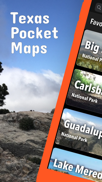
Be prepared! Plan your next trip to one of the great Texas parks. Download maps and guides before you venture into the Wi-Fi free wilderness.
Discover
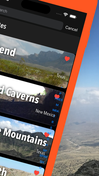
- 110+ national parks, state parks, monuments, forests
- 90+ neatly folded maps by the National Park Service, Bureau of Land Management, United States Forest Services, and other agencies.
- Motor Vehicle Use Maps (MVUM), Motor Vehicle Travel Maps (MVTM) and visitor maps for Texas national forests.
- 800+ campgrounds and campsites
- 1,800+ trails and trailheads
- 130,000+ points of interests
Plan
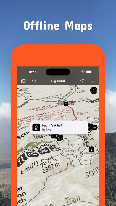
- Download maps, park brochures, and newspapers. These downloads are ready when you are offline and off the grid in the great outdoors.
- …
Read the full description
Be prepared! Plan your next trip to one of the great Texas parks. Download maps and guides before you venture into the Wi-Fi free wilderness. Discover - 110+ national parks, state parks, monuments, forests - 90+ neatly folded maps by the National Park Service, Bureau of Land Management, United States Forest Services, and other agencies. - Motor Vehicle Use Maps (MVUM), Motor Vehicle Travel Maps (MVTM) and visitor maps for Texas national forests. - 800+ campgrounds and campsites - 1,800+ trails and trailheads - 130,000+ points of interests Plan - Download maps, park brochures, and newspapers. These downloads are ready when you are offline and off the grid in the great outdoors. - Download arbitrary map sections as offline packs. - Photo galleries, panorama views. - Share links to parks and maps with friends Have fun - GPS and GPX support: record your hikes, import GPX routes, tracks and waypoints for your hiking trails. - Detailed national park information: alerts, news, visitor centers, campgrounds, driving directions, weather. - Open your favorite maps app to get a route to the selected park. - Current weather conditions, easy access to multi-day forecasts, sunrise and sunset times. - Push notifications for park alerts, park news, weather warnings So download maps and guides for: - Abilene, Alibates Flint Quarries, Amistad, Anahuac, Angelina, Aransas, Atlanta, Attwater Prairie Chicken - Balcones Canyonlands, Balmorhea, Bastrop, Bentsen-Rio Grande Valley, Big Bend, Big Bend Ranch, Big Bogggy, Big Spring, Big Thicket, Blanco, Bonham, Brazoria, Brazos Bend, Buescher, Buffalo Lake - Caddo, Caddo Lake, Caprock Canyons, Carlsbad Caverns, Cedar Hill, Chamizal, Chickasaw, Choke Canyon, Cleburne, Colorado Bend, Cooper Lake, Copper Breaks - Daingerfield, Davis Mountains, Davy Crockett, Devils River, Devil's Sinkhole, Dinosuar Valley - Eisenhower, El Camino Real de los Tejas, El Camino Real de Tierra Dentro, Enchanted Rock, Estero Llano Grande - Fairfield Lake, Falcon, Fort Davis, Fort Parker, Franklin Mountains - Garner, Government Canyon, Grulla, Guadalupe Mountains - Hagerman, Hill Country, Hueco Tanks, Huntsville - Inks Lake - Kickapoo Cavern - Laguna Atascosa, Lake Bob Sandlin, Lake Brownwood, Lake Colorado City, Lake Meredith, Lake Mineral Wells, Lake Tawakoni, Lake Whitney, Longhorn Cavern, Lost Maples, Lower Rio Grande Valley, Lyndon B Johnson - Martin Creek Lake, McFaddin, Mission Tejas, Monahans Sandhills, Muleshoe, Mustang Island - Neches River - Padre Island, Palo Alto Battlefield, Palo Duro Canyon, Pedernales Falls, Posssum Kingdom, President William Jefferson Clinton Birthplace Home, Purtis Creek, - Ray Roberts Lake, Resaca de la Palma, Rio Grande - Sabine, Sam Houston, San Angelo, San Antonio Missions, San Bernard, Santa Ana, Sea Rim, Somerville Lake, South Llano River - Texas Point, Trinity River - Waco Mammoth, Washita Battlefield, White Sands LEGAL Terms of Use: https://www.icoat.de/pocketmaps/terms Privacy Policy: https://www.icoat.de/pocketmaps/privacy
Installs since 29 Aug 2026
Apple does not publish download counts. Estimates are in testing.
Estimated store revenue Estimated Beta
App Store, worldwide, monthly rate from the last 13 chart days to 20 Nov 2026
Below the top 100 grossing apps in the markets we calibrate. In the United States that usually means under about $6.4M a month. App Store purchases and subscriptions only, before Apple's 15 to 30% fee. Ads and web payments are not included.
Ratings
89 ratings, 89 reviews
No rating breakdown published for this app.
Recent reviews
Latest public reviews from the store
No reviews in our sample for this app yet.
Top chart positions
Latest App Store chart ranks by country, last 10 days
Not in any tracked top chart in the last 10 days.
Texas Pocket Maps history
Release, install milestones, listing and store changes
- First released on the store 4 May 2019
Update frequency
How often Texas Pocket Maps ships a new version, month by month
4 updates in the last 12 months. More often than most similar apps: they shipped a median of 2 updates in the same year.
Recent versions
Current version 8.1
- Version 8.122 Oct 2026
Fall 2026 Updates! Explore Texas's wilderness with our new navigation tools and advanced data features. What's New • Edit title, description, sport, difficulty, emoji, stars and shape of your routes and activities. • Redesigned route overview lists. • Edit estimated duration for your route. • Time of arrival prediction based on your average speed and estimated route duration. • Track recording with 2 new panels for current and remaining route data. • Performance Boost: Fixed general bugs and optimized code for smoother, faster tracking. Map Updates Updated Trail Details: Explore the latest routes, points of interest, and facilities in Texas. • Trusted data Built with official information from the National Park Service, Bureau of Land Management, US Forest Service, recreation.gov, and other agencies.
- Version 8.027 Aug 2026
Late Summer 2026 Updates! Explore Texas's wilderness with our new navigation tools and advanced data features. What's New • Data-Rich Elevation Profiles: Track duration, distance, relative elevation, and your exact location at a glance on your updated elevation graph. • Custom 'Standard' Map Style: Choose our beautifully streamlined custom map interface in your settings. • Instant POI Information: Long-press anywhere on the map to instantly reveal nearby points of interest. • High-Visibility Location Marker: Stay found on the trail with a larger, high-contrast map marker. • Refreshed Map Icons: Spot campgrounds, trailheads, and landmarks quickly with updated iconography. • Smooth navigation between map, route and waypoint details. • See elevation gain/loss data in the list of route waypoints. • Activity summary with distance, duration, speed, pace, elevation gain/loss, min/max elevation, start/end, ascent/descent duration and speed, distance effort. • Performance Boost: Fixed general bugs and optimized code for smoother, faster tracking. Map Updates Updated Trail Details: Explore the latest routes, points of interest, and facilities in Texas. • Trusted data Built with official information from the National Park Service, Bureau of Land Management, US Forest Service, recreation.gov, and other agencies.
- Version 7.927 Jun 2026
Early Summer 2026 Updates! • New Features Shows list of waypoints along track/route. Better map readability: Your map is now easier to read! Icons and text labels now respect your systems font size preferences. New style: current route is shown in blue, current track recording in red with distance markers. New: Show-on-map switch with context menu to toggle display of distance markers. New: Interactive elevation diagram to see elevation, duration and position on map. Fix: More efficient GPS recording with better battery life. • Trusted data Built with official information from the National Park Service, Bureau of Land Management, US Forest Service, recreation.gov, and other agencies.
- Version 7.813 Apr 2026
Early Spring 2026 Updates! • New Features New icons for start/finish and waypoint markers. • Trusted data Built with official information from the National Park Service, Bureau of Land Management, US Forest Service, recreation.gov, and other agencies.
Listing keywords
Words and phrases Texas Pocket Maps repeats most in its store listing
Top phrases: download maps (3), rio grande (3), camino real de (2), el camino real (2), maps and guides (2).
Highlighted words also appear in the title. Counts cover the title, short description and description.
Compliance
What the listing and the app package show
- Store status
- Live
- Upkeep
- Updated 22 Oct 2026
- Age rating
- 4+
Apps like Texas Pocket Maps
 KrugerExplorerExplorer Apps★ 4.73
 PARIS Guide Tickets & HotelsZF s.r.l.★ 4.71
 WikiTrip – Travel Audio GuideBjörn Schefzyk★ 4.51
 My Spot - Find, Mark, ShareMatthew Mech★ 4.5
 Spots: Discover Amazing PlacesSpots★ 4.05
 City Tour WorldwideCity Tour Worldwide★ 1.27
 Kyoto Travel Guide .Gonzalo Martin★ 4.4
 ZonzoFox - Italy GuideZF s.r.l.★ 4.85
 Bahrain TaxiBahrain Taxi★ 4.6
Texas Pocket Maps: questions and answers
Who makes Texas Pocket Maps?
Texas Pocket Maps is published by Alex Gugel.
When was Texas Pocket Maps last updated?
The latest version (8.1) was released on 22 Oct 2026.
Is Texas Pocket Maps free?
Yes. Texas Pocket Maps is free to download.
Is Texas Pocket Maps still available?
Yes. Texas Pocket Maps is live on App Store as of 14 Nov 2026.
Track Texas Pocket Maps and its competitors
Watch any app for new versions, rating drops, chart moves and removals. Free plan, no card.