
- Installs
- —
- Apple does not publish download counts
- Rating
- 4.7
- Ratings
- 906
- 906 reviews
- Version
- 9.1
- Updated 30 Jun 2025
- Released
- 30 Nov 2009
- Tracked since 10 May 2026
- Size
- 30 MB
- Needs 15.6
Also on Google Play: Theodolite (111 ratings)
Screenshots
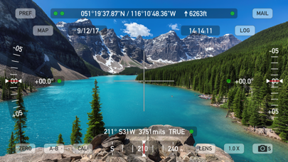
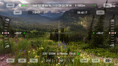
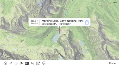
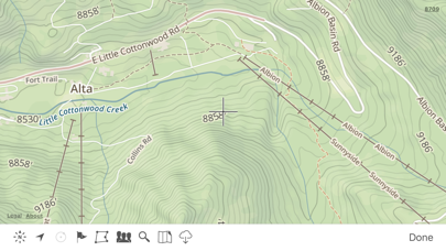
About Theodolite
The description on the store listing
Theodolite is a multi-function viewfinder that combines a compass, two-axis inclinometer, rangefinder, GPS, map, nav calculator, and geo-overlay photo/movie camera into one indispensable app. Theodolite was one of the very first augmented reality (AR) apps when it was released in 2009, and it’s been downloaded and used by millions of customers since then. Uses are endless, and the app is great for land measurements, outdoor sports, sightseeing, navigation, and finding your way around. Theodolite is a pro grade app and is used extensively by surveyors, geologists, architects, engineers, competitive sportsmen, first responders, military personnel, and search and rescue workers around the …
Read the full description
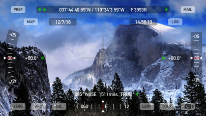
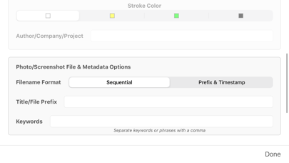
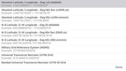
Theodolite is a multi-function viewfinder that combines a compass, two-axis inclinometer, rangefinder, GPS, map, nav calculator, and geo-overlay photo/movie camera into one indispensable app. Theodolite was one of the very first augmented reality (AR) apps when it was released in 2009, and it’s been downloaded and used by millions of customers since then. Uses are endless, and the app is great for land measurements, outdoor sports, sightseeing, navigation, and finding your way around. Theodolite is a pro grade app and is used extensively by surveyors, geologists, architects, engineers, competitive sportsmen, first responders, military personnel, and search and rescue workers around the world. Theodolite lets you take data-overlay photos and movies with 2X-8X zoom. Overlay geographical data, angle markings, date/time, author/company info, and project notes directly on photos and movies for later reference. The same data is written into the metadata record of images, making image files self-contained data records. Third-party apps can tap into Theodolite's advanced camera functions with a camera sharing feature. View current position on the built-in map with optional offline Outdoors maps that include topo contours, roads, trails, landmarks, campgrounds, ski lifts, and more. Live map markers continually update distance/heading relative to the current location and also show wayfinding info in the main viewfinder. Draw polygons on the map to mark things like property boundaries and trails, and import/export polygon data via KML. Share map markers and nav calculator points with other users of Theodolite via text messages or e-mail. This powerful capability opens up a wide range of collaborative uses including team land surveying, accident investigations, spotting wild fires, triangulation of landmarks, and advanced tactical observation and targeting. With an optional in-app purchase to enable team tracking, you can share location with up to 20 people on Theodolite's map. Theodolite includes features for serious users like a reference angle mode, nav calculator, map marker import/export, manual and automatic data logging with CSV and KML export, clipboard integration, %grade display, mil compass readout, optical rangefinders (including a mil-based reticle, sniper-style stadiametric graphs, and a variable 4X-24X scope), and night filters to improve use in dark conditions. Theodolite can provide location in military grid reference system (MGRS) coordinates, Universal Transverse Mercator (UTM) coordinates, British/Irish National Grids, US National Grid, Maidenhead locator system, Map Grid of Australia, and six latitude/longitude formats. Optional US State Plane coordinates include SPCS27 and SPCS83 zones covering all US States. The optional Datum Pack adds over 230 geodetic datums to the app to improve position computation from GPS data, covering regions and countries on all continents around the world. AR Layers include navigational aids like the sun, moon, planets, and Polaris (North star), and the optional US Mountain Summits layer that shows over 70,000 US mountain summits in the viewfinder. Theodolite has been shown in Apple Keynotes, featured on the App Store, and has been a #1 selling Navigation app in App Stores around the world. Since its introduction in 2009, Theodolite has defined augmented reality navigation. The app continually introduces new technologies, pushing the limits of iOS app development and taking advantage of new hardware capabilities. Find out why Apple named Theodolite one of the most amazing apps available and showed it being used to explore the Great Wall of China. Where will you take it on your next adventure? Note: Theodolite is an iPhone app -- see “Theodolite HD” for use on an iPad. And be sure to check out the all-new "Theodolite for Watch" and put Theodolite on your wrist!
Installs since 29 Aug 2026
Apple does not publish download counts. Estimates are in testing.
Estimated store revenue Estimated Beta
App Store, worldwide, monthly rate from the last 12 chart days to 19 Nov 2026
Below the top 100 grossing apps in the markets we calibrate. In the United States that usually means under about $6.4M a month. App Store purchases and subscriptions only, before Apple's 15 to 30% fee. Ads and web payments are not included.
Ratings
906 ratings, 906 reviews
No rating breakdown published for this app.
Recent reviews
Latest public reviews from the store
- 22 Apr 2025
Nice app—Bundle isn’t complete
Visually beautiful. Clear on-screen layouts and useful outdoor navigational information in the theodolite and compass apps. Altimeter…meh, informative but not eye-catching but maybe that’s its point (?). Weather? Yeah, there are hundreds of apps that do that, so it’s not really the selling point of the app. However, I am very disappointed that (1) the bundle does not include the Apple Watch apps and the various datum sets and (2) even more puzzled/peeved that the purchase of the datum for one app in the bundle does not make those datum available for use with the other apps in the set. It doesn’t really seem like a “bundle” especially when there are other apps available from other vendors that do as much but without the “nickel and dime” price escalation every time you open the preferences. In short, I’m pleased with the compass (on the phone) but will likely not find use for the rest of the apps as they each require additional purchases for base map datum($3) and localized maps/state plane coordinates ($25).
- 20 Mar 2024
Shows the best of a smartphone
I have had this app for many years. I write very few reviews and this is one of the few I felt compelled to comment upon. This is probably one of the best and most powerful apps I have seen and shows the best of what a smartphone can do. Many, most may not need or appreciate something like this but I find it remarkable what can be done with a phone in our pocket. If you are reading reviews on this app though, you are probably in the other category. If you know anything about maps, orienteering, surveying, flying or navigating this is remarkable. Get it. I buy almost no apps but this one I did and still think it is so worth it. To the devs, sincerely thank you. Be very cool if USGS maps could be downloaded and used as some kind of offline overlay or AR, IDK but a thought that occurred to me….
- 13 Aug 2023
An Outstanding App. Accurate. Best App For The Job.
Very sensitive. Better accuracy if placed on a fixed platform or stand. Fine detail measurements. The slightest movement is measured. On each of the scales, compass for example, the reading doesn’t bounce between each degree. Movement slides smoothly between the degrees and angles. I’ve never used a surveyor’s theodolite. But, I think this app gives you enough features to roughly measure your property. There are additional features you can get that provide even more professional land features. Get this free application. Rate it! Rate it! Rate it! Simply put, I love this app and I’m sure you will appreciate it too.
- 20 Sep 2022
Fun for the map-minded casual explorer
Really enjoying the app. Uses for me include designing multi-stage geocaches where I need bearing and distance between points for the stages. Also was walking on the beach and was curious how far away a cell tower was, and the A-B feature made it easy to triangulate and see the estimated position on the map. The controls feel really responsive (for example the zoom in/out) and the UI is clear and easy to use. Love the translucent pillar that appears in the viewfinder to show you the location of the current active map point, and how it changes to a planted flag when you get closer. Also super easy to share out coords by copying the text-based log or by generating an email with coords and tagged photo. AR planet layer is neat, and I like how putting crosshairs on a planet causes a name label to appear.
What reviewers bring up
Topics mentioned in the latest 8 reviews, by how many reviews mention them
Liked in good reviews (7 reviews)
- example 4
- map 4
- theodolite 3
- reading 3
- think 3
- photo 3
- find 3
- job 3
Raised in bad reviews (0 reviews)
No topic comes up twice.
Top chart positions
Latest App Store chart ranks by country, last 10 days
- Countries ranked
- 50 of 50
- Best rank
- #2
- Top 10 placements
- 9
- of 73 chart placements
- Average rank
- #38.6
Best countries on App Store
- 🇨🇦 Canada · Top paid, Navigation#2
- 🇳🇴 Norway · Top paid, Navigation#3
- 🇩🇪 Germany · Top paid, Navigation#4
- 🇬🇧 United Kingdom · Top paid, Navigation#6
- 🇳🇬 Nigeria · Top paid, Navigation#7
- 🇭🇰 Hong Kong SAR China · Top paid, Navigation#8
| Country | Chart | Category | Rank | Best (10 days) | Date |
|---|---|---|---|---|---|
| 🇨🇦 Canada | Top paid | Navigation | #2 | #2 | 19 Nov 2026 |
| 🇳🇴 Norway | Top paid | Navigation | #3 | #3 | 19 Nov 2026 |
| 🇩🇪 Germany | Top paid | Navigation | #4 | #4 | 19 Nov 2026 |
| 🇬🇧 United Kingdom | Top paid | Navigation | #6 | #6 | 19 Nov 2026 |
| 🇳🇬 Nigeria | Top paid | Navigation | #7 | #7 | 19 Nov 2026 |
| 🇭🇰 Hong Kong SAR China | Top paid | Navigation | #8 | #2 | 19 Nov 2026 |
| 🇳🇱 Netherlands | Top paid | Navigation | #8 | #2 | 19 Nov 2026 |
| 🇮🇪 Ireland | Top paid | Navigation | #10 | #1 | 19 Nov 2026 |
| 🇬🇷 Greece | Top paid | Navigation | #10 | #10 | 19 Nov 2026 |
| 🇲🇾 Malaysia | Top paid | Navigation | #11 | #8 | 19 Nov 2026 |
Theodolite history
Release, install milestones, listing and store changes
- First released on the store 30 Nov 2009
Recent versions
Current version 9.1
- Version 9.130 Jun 2025
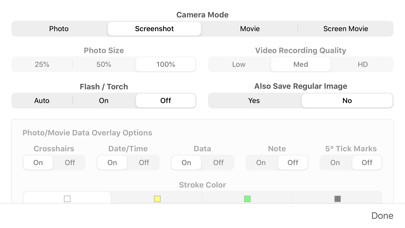
New measure tool on map screen to compute distance and heading. Polygon popup label now includes perimeter length. Enlarged size of touch target for camera shutter button to include entire lower corner of screen for easier taps. Options to control specific geo-data elements included in photo/movie overlay. Revised rangefinder code for better fidelity on multi-lens camera systems. Fixed issue where certain characters in map marker titles would cause problems for KML export to Google Earth. Updated camera sharing feature that allows other apps to use Theodolite's camera for image & data capture. Minor bug fixes and tweaks.
Listing keywords
Words and phrases Theodolite repeats most in its store listing
Top phrases: nav calculator (3), photos and movies (2), augmented reality (2), import export (2), map markers (2).
Highlighted words also appear in the title. Counts cover the title, short description and description.
Compliance
What the listing and the app package show
- Store status
- Live
- Upkeep
- Updated 30 Jun 2025
- Age rating
- 4+
Apps like Theodolite
 ZipPassSacramento Regional Transit District★ 4.52
 NaviGator for Gainesville RTSJonathan Wukitsch★ 4.79
 GPSPlus - GPS EXIF Editor汝泉 张★ 4.02
 Speedometer∞Baulin Roman★ 4.26
 NoodoeNoodoe Corporation★ 4.52
 Washington Road ConditionsLW Brands, LLC★ 4.66
 Garmin Smartphone LinkGarmin★ 2.0
 iTrack: Kids Location TrackerPhone Tracker & Family Link Apps★ 3.88
 Guardians from TruecallerTrue Software Scandinavia AB★ 4.63
Theodolite: questions and answers
Who makes Theodolite?
Theodolite is published by Craig Hunter.
When was Theodolite last updated?
The latest version (9.1) was released on 30 Jun 2025.
Is Theodolite free?
No. Theodolite is a paid app priced at $8.99.
Is Theodolite still available?
Yes. Theodolite is live on App Store as of 14 Nov 2026.
Track Theodolite and its competitors
Watch any app for new versions, rating drops, chart moves and removals. Free plan, no card.