
- Installs
- —
- Apple does not publish download counts
- Rating
- 4.33
- Ratings
- 129
- 129 reviews
- Version
- 1.19
- Updated 18 Apr 2023
- Released
- 27 Mar 2009
- Tracked since 10 May 2026
- Size
- 112 MB
- Needs 13.0
Screenshots
About Topo Maps
The description on the store listing
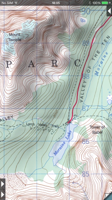
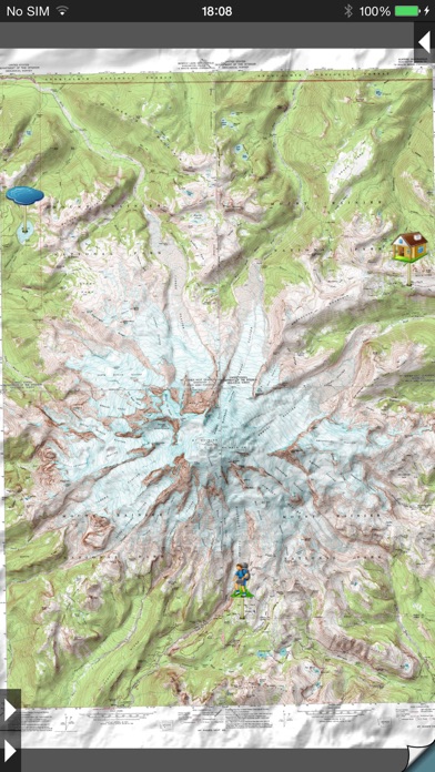
* View over 70,000 Natural Resources Canada 1:50,000 and USGS 1:24,000 topographical maps on your iPhone or iPod touch. * Ideal for hiking and other backcountry activities. * Map downloads are FREE! * More than 16 million maps downloaded so far!
- iPad owners, please see the app "Topo Maps for iPad".
* Users write:
" I've bought all the topo map apps and I like this the best "
" Scans are gorgeous ... the interface is exceptionally clean "
" Downloading maps is easy and fast ... Map displays beautifully and zooms flawlessly "
* Includes Canada (at 1:50,000), the contiguous US (at 1:24,000), Alaska (at 1:24,000 and 1:63,360), Hawaii, Puerto Rico and the U.S. Virgin Islands.
* …
Read the full description
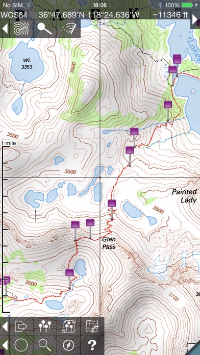
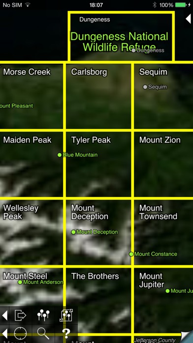
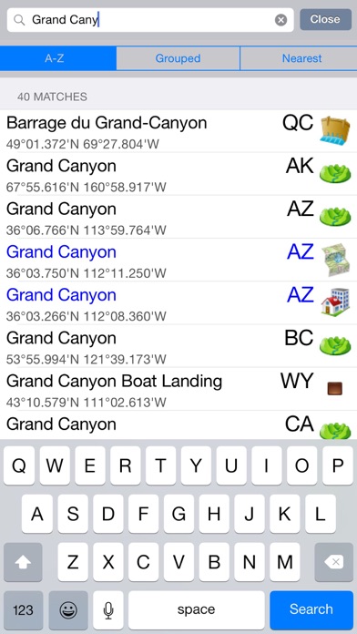
* View over 70,000 Natural Resources Canada 1:50,000 and USGS 1:24,000 topographical maps on your iPhone or iPod touch. * Ideal for hiking and other backcountry activities. * Map downloads are FREE! * More than 16 million maps downloaded so far! - iPad owners, please see the app "Topo Maps for iPad". * Users write: " I've bought all the topo map apps and I like this the best " " Scans are gorgeous ... the interface is exceptionally clean " " Downloading maps is easy and fast ... Map displays beautifully and zooms flawlessly " * Includes Canada (at 1:50,000), the contiguous US (at 1:24,000), Alaska (at 1:24,000 and 1:63,360), Hawaii, Puerto Rico and the U.S. Virgin Islands. * Locate the maps you need on the satellite view. To install a map, touch for about half a second. Touch again to view it. * Search by name for over a million towns, peaks, lakes, parks and other features. * No network connection is needed once the maps have been installed. * Mark waypoints, and import and export waypoint files in GPX, KML and CSV formats. * Touch the "current location" button to see where you are, and the compass button to align the map with the ground. * See coordinates in NAD27 or WGS84 degrees, degrees minutes and seconds, UTM, or MGRS formats. * Measure distances (miles, feet and km) and bearings (true and magnetic). The Maps: This app uses high-quality scans of the traditional USGS and NRCan topographic maps which have been the definitive resource for hikers and other backcountry users for many years. You can make the terrain stand out with hill shading, using simulated sunlight from the direction of your choice. In the U.S., this app does not use the new "US Topo" maps because they do not show hiking trails and lack other details: please see the web site for more details. Downloading: US maps are around 8 MB in size and download in a few seconds on a typical home broadband connection. Canadian maps are larger. Both cellular data and WiFi can be used, though WiFi is likely to be more reliable in most cases. - Do please visit https://topomapsapp.com/ for complete instructions, so that you don't miss any features. We have many ideas for additional features to add to future versions of this app; if you have ideas or other questions or comments, contact details can be found on the website, https://topomapsapp.com/. The website also has more screenshots and other information.
Installs since 29 Aug 2026
Apple does not publish download counts. Estimates are in testing.
Estimated store revenue Estimated Beta
App Store, worldwide, monthly rate from the last 13 chart days to 20 Nov 2026
Below the top 100 grossing apps in the markets we calibrate. In the United States that usually means under about $6.4M a month. App Store purchases and subscriptions only, before Apple's 15 to 30% fee. Ads and web payments are not included.
Ratings
129 ratings, 129 reviews
No rating breakdown published for this app.
Recent reviews
Latest public reviews from the store
- 7 Oct 2025
Issue w/ Downloading Maps is Fixed!
OCTOBER 2025: The issue with being unable to download new maps to my device has been fixed. when trying to download new maps, I would get an error message saying the map wasn’t available for download or something like that. I sent an email to the app developer last night, and six hours later he had responded and said the problem was fixed. And it really was! After all these years, this is still the best topographic map app out there for use in conjunction with hiking and exploring.
- 26 May 2025
Nothing Better for Exploring
I’ve been using these topo maps for years - pretty much everywhere I go I download the local area with these maps if I’m going to be out and about at all. Also, where I live I like to explore the back country, often overland with no trails or roads or on old two-track roads hours away from anywhere with cell service. These maps have been invaluable for offline use. I would say, however, that the most interesting use has been the fact that the old WGS84 took maps this app uses show a huge amount of things that modern maps omit. Old structures, mines, prospects, old roads, trails, and miscellaneous items that have been forgotten by all - including modern cartographers - are shown on these maps. A lot of these old things are still around, and are still visible even on satellite maps, but if you were only using modern (non-satellite) maps you would never know they were there many times. I love detail, and I hate how modern maps ignore so many different features that are in fact extant. These maps are perfect in ways so many other newer maps fail. A few things I wish it had though: 1. The ability to add kml files, including tracks and shapes etc. 2. A mode where the gps would sti
- 25 Feb 2023
Almost perfect NO SUBSCRIPTION Topo app
I have used this app for years, iPhone 4 days. I wish the developer would update the maps but even as it is it is far more useful than most. It seems like it’s been abandoned which is sad. But it’s still worth it, You pay ONCE and have access to download Topo maps of the entire U.S. for as long as you want. All on your phone so no data connection needed. All is not roses though. - alignment is seriously bad in some places. Laughably so. Central Washington state has maps so far out of alignment that adjoing maps look like cards tossed randomly on a table. I have paper USGS Topo maps of the exact same sections and those align perfectly. My National Geographic Topo maps of the same area align perfectly as does my Gaia GPS app. Not sure why these are so badly out of whack. Seems to happen somewhere in areas of various different states i have downloaded maps for -there needs to be a GPS tracking feature. So the app lays down a trail that follows your progress and the tracks can be saved and recalled. The app is really lacking in usefulness without that feature. I am still having to use Topo! Which has this feature so I can save tracks of my adventures. I would love to not have
- 8 Dec 2021
Great…Could be magnificent
I like almost everything about this app. Suggested improvement: 1) Allow downloads of satellite imagery in tiles. I have to use other apps for this, but I’d love the option to zoom in and auto switch from Topo to Sat imagery. It’s annoying on other apps you can download imagery, but you never know how much data is being overwritten in the cache memory of the app…so you never know if looking at a new area cause the other area to ‘zero out.’ Downloading tiles would ensure that anything downloaded remains downloaded in only the areas you want. 2) Allow line of sight calculator to add an up to 15% beyond calculation for more realistic propagation of radio waves. The line of sight tool is a fantastic for estimating UHF reception probability while using the direction and distance calculator. If there was a slider to add a yellow color cast to anything 1-15% beyond line of sight, this would assist in estimating UHF/VHF ground wave propagation/refraction fresnel effect of RF energy. 3) Add center point options for your location other than blue dot. All in all, great app…could be even better.
What reviewers bring up
Topics mentioned in the latest 8 reviews, by how many reviews mention them
Liked in good reviews (7 reviews)
- maps 6
- download 5
- topo 5
- location 4
- other 4
- gps 4
- problem 3
- these 3
Raised in bad reviews (0 reviews)
No topic comes up twice.
Top chart positions
Latest App Store chart ranks by country, last 10 days
- Countries ranked
- 4 of 50
- Best rank
- #29
- Top 10 placements
- 0
- of 4 chart placements
- Average rank
- #69.8
Best countries on App Store
- 🇨🇦 Canada · Top paid, Navigation#29
- 🇮🇱 Israel · Top paid, Navigation#65
- 🇺🇸 United States · Top paid, Navigation#92
- 🇳🇿 New Zealand · Top paid, Navigation#93
Topo Maps history
Release, install milestones, listing and store changes
- First released on the store 27 Mar 2009
Update frequency
How often Topo Maps ships a new version, month by month
0 updates in the last 12 months. Less often than most similar apps: they shipped a median of 2 updates in the same year.
Recent versions
Current version 1.19
- Version 1.1918 Apr 2023
This is a minor update to fix bugs.
Listing keywords
Words and phrases Topo Maps repeats most in its store listing
Top phrases: topo maps (3), please see (2).
Highlighted words also appear in the title. Counts cover the title, short description and description.
Compliance
What the listing and the app package show
- Store status
- Live
- Upkeep
- No update since 18 Apr 2023
- Age rating
- 17+
Apps like Topo Maps
 Military GPS Survival KitTigran Mkhitaryan★ 4.52
 Pelican: Automotive assistantFearless design, LLC★ 4.1
 Maine Snowmobile AssociationMapGears inc.★ 4.48
 getBUS - RealTime Bus TrackingGennady Dmitrik★ 4.71
 Idaho 511IBI Group★ 1.62
- Spectrum TrackingSpectrum Tracking INC.★ 3.78
 AvareXZubair Khan★ 4.63
 enRoute Route PlannerBusiness Suite Apps Maker for Free★ 3.28
 IDrive ArkansasNICUSA★ 3.52
Topo Maps: questions and answers
Who makes Topo Maps?
Topo Maps is published by Mappendix Limited.
When was Topo Maps last updated?
The latest version (1.19) was released on 18 Apr 2023.
Is Topo Maps free?
No. Topo Maps is a paid app priced at $19.99.
Is Topo Maps still available?
Yes. Topo Maps is live on App Store as of 14 Nov 2026.
Track Topo Maps and its competitors
Watch any app for new versions, rating drops, chart moves and removals. Free plan, no card.