
AlpineQuest Explorer Lite
Turn your phone into a real off-road GPS using off-line topo maps!
- Installs
- 5.31M
- Measured
- Rating
- 4.5
- Ratings
- 20.6K
- 474 reviews
- Version
- 2.4.1
- Updated 21 Oct 2026
- Released
- 28 Mar 2010
- Tracked since 14 May 2026
- Size
- 7 MB
- Needs 3.0
Screenshots
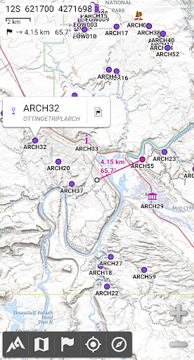
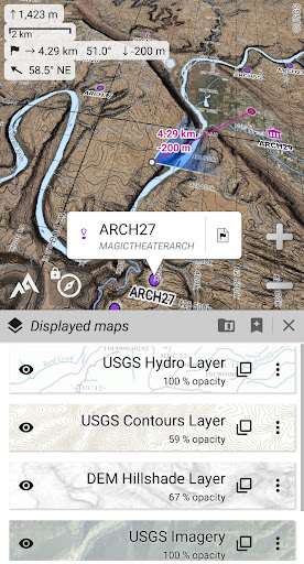
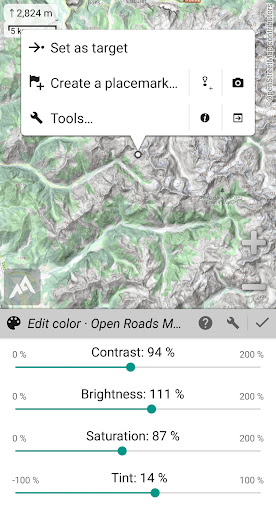


About AlpineQuest Explorer Lite
The description on the store listing
<b>No advertisements ~ No data sharing & monetization ~ No analytics ~ No third party libraries</b>
AlpineQuest is <b>the complete solution for all outdoor activities and sports</b>, including hiking, running, trailing, hunting, sailing, geocaching, off-road navigation and much more.
You can access and store locally a large range of <b>on-line topographic maps, which will remain available</b> even while being out of cell coverage. AlpineQuest also supports many <b>on-board file-based raster map</b> formats.
By using the GPS and the magnetic sensor of your device (with compass display), getting lost is part of the past: <b>you are localized in real-time on the map</b>, which can …
Read the full description
<b>No advertisements ~ No data sharing & monetization ~ No analytics ~ No third party libraries</b> AlpineQuest is <b>the complete solution for all outdoor activities and sports</b>, including hiking, running, trailing, hunting, sailing, geocaching, off-road navigation and much more. You can access and store locally a large range of <b>on-line topographic maps, which will remain available</b> even while being out of cell coverage. AlpineQuest also supports many <b>on-board file-based raster map</b> formats. By using the GPS and the magnetic sensor of your device (with compass display), getting lost is part of the past: <b>you are localized in real-time on the map</b>, which can also <b>be oriented</b> to match where you are looking at. Save and retrieve unlimited <b>placemarks</b>, share them with your friends. <b>Track</b> your path, get <b>advanced statistics</b> and <b>interactive graphics</b>. You won’t have anymore questions about what you can accomplish. By staying fully operational out of cell coverage (as often in mountain or abroad), AlpineQuest assists you in all your desires of deep wilderness exploring… <b>Don’t hesitate, use this Lite version right now for free!</b> PLEASE report suggestions and issues on our dedicated forum https://www.alpinequest.net/forum (no registration needed, all questions answered) and not in comments. <u><b>Key features are</b></u> (for full version): ★★ <b>Maps</b> ★★ • Built-in <b>online maps</b> (with <b>automatic local storage</b>; road, topo and satellite maps included) and <b>online layers</b> (road names, hillshade, contours); • Get more online maps and layers in one click from the included community maps list (all major worldwide maps and many local topo maps); • Complete <b>area storage</b> of online maps for off-line use; • <b>On-board offline maps</b> support (raster) including <b>KMZ Overlays, OziExplorer OZFx2, OZFx3 (partly) and calibrated images, GeoTiff, GeoPackage GeoPkg, MbTile, SqliteDB</b> and <b>TMS</b> zipped tiles (visit our website to get MOBAC, the free map creator); • <b>QuickChart</b> Memory Map support (.qct maps only, .qc3 maps not compatible); • Built-in <b>image calibration tool</b> to use any scan or picture as a map; • <b>Digital elevation model</b> on-board storage (1-arcsec SRTM DEM) and support for <b>HGT</b> elevation files (both 1-arcsec and 3-arcsec resolutions) allowing display of <b>terrain</b>, <b>hillshade</b> and <b>steep slopes</b>; • <b>Polar maps</b> (Arctic and Antarctic) support; • Multiple <b>maps in layers</b> display, with per-map opacity/contrast/color/tint/blending control. ★★ <b>Placemarks</b> ★★ • Create, display, save, restore <b>unlimited number of items</b> (waypoints, routes, areas and tracks); • Import/export <b>GPX</b> files, <b>Google Earth KML/KMZ</b> files and <b>CSV/TSV</b> files; • Import <b>ShapeFile SHP/PRJ/DBF, OziExplorer WPT/PLT, GeoJSON, IGC tracks, Geocaching LOC</b> waypoints and export <b>AutoCAD DXF</b> files; • Save and share online locations with other users using Community Placemarks; • <b>Details</b>, <b>advanced statistics</b> and <b>interactive graphics</b> on various items; • Time Controller to replay time-tagged tracks. ★★ <b>GNSS Position / Orientation</b> ★★ • On-map geolocation using device GNSS receivers (GPS/Glonass/Galileo/…) or Network; • Map orientation, <b>compass</b> and target finder; • Built-in <b>GNSS/Barometric track recorder</b> (long tracking capable, running in a separate and light process) with battery level and network strength recording; • Proximity alerts and leave path alerts; • Barometer support (compatible devices). ★★ <b>And more</b> ★★ • Metric, imperial, nautical and hybrid distance units; • Latitude/Longitude and grid coordinate formats (WGS, UTM, MGRS, USNG, OSGB, SK42, Lambert, QTH, …) with on-map grids display; • Ability to import hundreds of coordinate formats from https://www.spatialreference.org; • …
Installs, last 30 days Measured
Exact Google Play install counts, collected daily
Ratings
20,557 ratings, 474 reviews
- 5 ★80%
- 4 ★6.9%
- 3 ★4.0%
- 2 ★4.0%
- 1 ★5.0%
Recent reviews
Latest public reviews from the store
- 9 May 2026
very nice up
- 9 May 2026
Absolutely amazing app with accuracy of location information
- 26 Apr 2026
best app for maps. gives details accurately. fantastic
- 13 Apr 2026
good map
What reviewers bring up
Topics mentioned in the latest 50 reviews, by how many reviews mention them
Liked in good reviews (44 reviews)
- map 7
- useful 3
- alpinequest 2
- absolutely 2
- offline 2
- aap 2
Raised in bad reviews (4 reviews)
No topic comes up twice.
Top chart positions
Latest Google Play chart ranks by country, last 10 days
- Countries ranked
- 2
- Best rank
- #94
- Top 10 placements
- 0
- of 2 chart placements
- Average rank
- #141
Best countries on Google Play
- 🇮🇩 Indonesia · Top free, Travel & Local#94
- 🇧🇷 Brazil · Top free, Travel & Local#188
AlpineQuest Explorer Lite history
Release, install milestones, listing and store changes
- Moved from Maps & Navigation to Travel & Local 5 Apr 2022
- Reached 1,000,000+ installs 11 May 2019
- Moved from Travel & Local to Maps & Navigation 27 Apr 2019
- First released on the store 28 Mar 2010
Update frequency
How often AlpineQuest Explorer Lite ships a new version, month by month
3 updates in the last 12 months. Less often than most similar apps: they shipped a median of 9 updates in the same year.
Recent versions
Current version 2.4.1
- Version 2.4.121 Oct 2026
2.4.1 • New default “AlpineQuest Topo” map covering the whole world; • Added an undo button in the placemarks creators/editors; • Added a recently used category in the icon selector; • Added a text field to filter icons by name in the icon selector; • Added a text field to filter location formats by name or country in the location format selectors; • Kilometers/miles markers are now displayed along tracks with a distance-based dynamic coloring; • Various improvements and bug fixes.
- Version 2.4.0e1 Jun 2026
2.4.0e • Various improvements and bug fixes.
- Version 2.4.0d30 Jan 2026
2.4.0d • Improved display on devices with screen cutout (notch); • Added ability to reorder displayed placemarks; • Added display of Indian National Grid system; • Various improvements and bug fixes.
- Version 2.4.0c24 Aug 2025
Listing keywords
Words and phrases AlpineQuest Explorer Lite repeats most in its store listing
Top phrases: online maps (3), statistics and interactive (2), advanced statistics (2), cell coverage (2), coordinate formats (2).
Highlighted words also appear in the title. Counts cover the title, short description and description.
Business model and tech
From the store listing and declared permissions
- Business model
- Free to downloadIn-app purchases
- Sensitive access
- No sensitive permission declared
Compliance
What the listing and the app package show
- Store status
- Live
- Upkeep
- Updated 21 Oct 2026
- Registered in
- Spain
- Privacy policy
- Linked on the listing
- Advertising
- No ads declared
- In-app purchases
- Offered
- Age rating
- Everyone
Apps like AlpineQuest Explorer Lite
Silencio: Measure Noise & EarnSilencio Network LLC695K installs★ 3.49
taxi.eu - Taxi App for Europetaxi.eu - fms systems gmbh2.2M installs★ 4.21
Tripomatic Planner & MapsTripomatic s.r.o.2.4M installs★ 4.17
Bipay WalletChilePasajes.cl629K installs★ 4.19
트리플 - 항공·호텔 최저가 예약, 여행계획Nol Universe Co., Ltd.6.7M installs★ 4.73
Austrian AirlinesLufthansa Group2M installs★ 4.92
Services - TotalEnergiesTotalEnergies Marketing & Services3M installs★ 2.59
Rede ExpressosRNE - REDE NACIONAL DE EXPRESSOS, LDA1.4M installs★ 4.46
TravelzooTravelzoo3.2M installs★ 4.55
AlpineQuest Explorer Lite: questions and answers
How many downloads does AlpineQuest Explorer Lite have?
AlpineQuest Explorer Lite has 5,312,447 installs on Google Play, measured from the store's own count on 20 Nov 2026.
Who makes AlpineQuest Explorer Lite?
AlpineQuest Explorer Lite is published by Psyberia, a developer based in ES.
When was AlpineQuest Explorer Lite last updated?
The latest version (2.4.1) was released on 21 Oct 2026.
Is AlpineQuest Explorer Lite free?
Yes. AlpineQuest Explorer Lite is free to download and offers in-app purchases.
Is AlpineQuest Explorer Lite still available?
Yes. AlpineQuest Explorer Lite is live on Google Play as of 20 Nov 2026.
Track AlpineQuest Explorer Lite and its competitors
Watch any app for new versions, rating drops, chart moves and removals. Free plan, no card.