
DroneSense CoPilot
Elevate public safety with real-time video streaming and GPS tracking.
- Installs
- 3.01K
- Measured
- Rating
- —
- Ratings
- —
- Version
- Varies with device
- Updated 14 Dec 2024
- Released
- 15 Mar 2024
- Tracked since 12 May 2026
- Size
- —
Screenshots


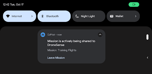


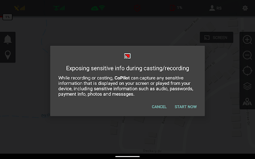

About DroneSense CoPilot
The description on the store listing
Elevate Public Safety with Real-Time Video Streaming and GPS Tracking
In the fast-paced world of public safety and emergency response, situational awareness is paramount. DroneSense brings you a purpose built platform designed to enhance on-scene coordination and decision-making. By turning every smartphone, tablet, drone, and even robots into a live broadcasting unit, we empower incident commanders and teams with unparalleled insights.
Why DroneSense CoPilot?
- Live Video Streaming: Share live video feeds from the ground or the sky directly with your command center. Whether it's a drone in flight or a mobile device in the hands of your team, DroneSense ensures that every angle is …
Read the full description
Elevate Public Safety with Real-Time Video Streaming and GPS Tracking In the fast-paced world of public safety and emergency response, situational awareness is paramount. DroneSense brings you a purpose built platform designed to enhance on-scene coordination and decision-making. By turning every smartphone, tablet, drone, and even robots into a live broadcasting unit, we empower incident commanders and teams with unparalleled insights. Why DroneSense CoPilot? - Live Video Streaming: Share live video feeds from the ground or the sky directly with your command center. Whether it's a drone in flight or a mobile device in the hands of your team, DroneSense ensures that every angle is covered. - GPS Location Sharing: Real-time tracking of all field assets provides a comprehensive operational picture. See the exact location of your teams, drones, and other assets, all live on an interactive map. - Enhanced Collaboration: Not just a viewing platform, DroneSense allows you to interact with the operational map. Build a real time operational picture together with everyone in the mission. Strategize and communicate more effectively. - Stream from Any Device: Screencast or share camera feeds from mobile devices to your mission's command and control center, DroneSense is as versatile as your needs. Elevate your response now… Imagine the power of having every cell phone, tablet, or camera-equipped device as part of your command center, providing live video streams and GPS locations from the field. With DroneSense, this is not just possible—it's easy. Our platform is designed specifically for public safety professionals who demand quick, reliable, and comprehensive oversight of their operations. Whether you're managing a critical incident or coordinating a large-scale event, DroneSense gives you the eyes and insights you need to make informed decisions. Download DroneSense CoPilot Today Ready to transform your approach to public safety and emergency response? Download the CoPilot app now and turn your device into the ultimate tool for enhanced situational awareness and strategic decision-making.
Installs since 29 Aug 2026 Measured
Exact Google Play install counts, collected daily
Ratings
- 5 ★0.0%
- 4 ★0.0%
- 3 ★0.0%
- 2 ★0.0%
- 1 ★0.0%
Recent reviews
Latest public reviews from the store
- 8 Apr 2023
What's the improvement of this app in 2.3.0 version? Should we need install harmony legacy for running a mission again? I have an issue. I'm using mavic pro when running the mission drone doesn't continue the mission after flight some waypoint and take some pictures, then it's just hovering. I tried to find some menu or button for continuing the mission but it doesn't work anything. So, I taken control my drone back to the home point. Could you fix this?
- 29 Mar 2023
Can't take off. It used to work until I got a replacement drone and now the app gives an error and can't take off. It works if the drone is already in the air, but I don't like the idea of losing control of the aircraft. Can you please help?
- 3 Apr 2021
Great app for making orthomosaics. Super easy to use. But in the last two days with my mavic air, my drone just flies up to about four feet and hovers. It won't complete the route and on my phone I see a message that says "recording stopped". Would love to keep using the app if you guys can fix this.
- 4 Feb 2019
If you own a DJI Spark and you want to use it for mapping, this app is exactly what you're looking for! I tried a lot of alternative apps and I can say that this one is definitely the best (again, in terms of compatibility with the Spark). I have been able to upload kml files and plan autonomous missions smoothly. A lot of people on internet say you can't use the Spark for mapping, but with this app I have been able to produce an excellent orthomosaic imagery and a very cool 3D model!
What reviewers bring up
Topics mentioned in the latest 10 reviews, by how many reviews mention them
Liked in good reviews (1 reviews)
No topic comes up twice.
Raised in bad reviews (6 reviews)
- android 2
- several 2
- without 2
- won't 2
- other 2
- dji 2
Top chart positions
Latest Google Play chart ranks by country, last 10 days
Not in any tracked top chart in the last 10 days.
DroneSense CoPilot history
Release, install milestones, listing and store changes
- Reached 1,000+ installs 14 Dec 2024
- Reached 500+ installs 13 Jul 2024
- First released on the store 15 Mar 2024
Listing keywords
Words and phrases DroneSense CoPilot repeats most in its store listing
Top phrases: public safety (5), dronesense copilot (3), live video (3), video streaming (3), elevate public safety (2).
Highlighted words also appear in the title. Counts cover the title, short description and description.
Business model and tech
From the store listing and declared permissions
- Business model
- Free to download
- Sensitive access
- No sensitive permission declared
Compliance
What the listing and the app package show
- Store status
- Live
- Upkeep
- Updated 14 Dec 2024
- Registered in
- United States
- Privacy policy
- Linked on the listing
- Advertising
- No ads declared
- In-app purchases
- None declared
- Age rating
- Everyone
Apps like DroneSense CoPilot
Такси "Рус-авто"BIT Master5.2K installs★ 4.0
TCS GoSafe MobileTata Consultancy Services Limited11.4K installs★ 1.0
부산버스 스마트OU Apps36.4K installs★ 3.7
Train Tracker BD LiveMD. Marajul Haque1.7K installs★ 4.78
AP Transit - NYC Subway MapAlexander Pozharov1.9K installs★ 4.33
Zirak CaptainZIRAK LLC2K installs★ 4.33
Diground ~Create and Share MAPDiground Inc.15.6K installs★ 3.1
ORIZOTecelys73.8K installs★ 3.6
VocaBus Horaires en temps réelSTGA9.7K installs★ 4.0
DroneSense CoPilot: questions and answers
How many downloads does DroneSense CoPilot have?
DroneSense CoPilot has 3,006 installs on Google Play, measured from the store's own count on 7 Nov 2026.
Who makes DroneSense CoPilot?
DroneSense CoPilot is published by DroneSense, a developer based in US.
When was DroneSense CoPilot last updated?
The latest version (Varies with device) was released on 14 Dec 2024.
Is DroneSense CoPilot free?
Yes. DroneSense CoPilot is free to download.
Is DroneSense CoPilot still available?
Yes. DroneSense CoPilot is live on Google Play as of 7 Nov 2026.
Track DroneSense CoPilot and its competitors
Watch any app for new versions, rating drops, chart moves and removals. Free plan, no card.