
- Installs
- —
- Apple does not publish download counts
- Rating
- 4.11
- Ratings
- 45
- 45 reviews
- Version
- 1.1.39
- Updated 29 May 2026
- Released
- 20 Sep 2020
- Tracked since 10 May 2026
- Size
- 20 MB
- Needs 15.0
Also on Google Play: Light Pollution Map, Light pollution map (81 ratings)
Screenshots



About Light Pollution Map
The description on the store listing
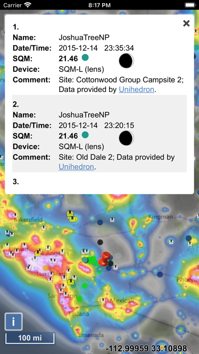
The map displays VIIRS/World Atlas/Clouds/Aurora/IAU observatories and the user SQM measurements.
The primary use is to show VIIRS/DMSP data in a friendly manner, but over time it also included some other interesting overlays that concern light pollution like SQM/SQC, World Atlas 2015 zenith brightness, clouds, aurora and IAU observatories. If you have a permanent SQM reader installed you can add it to the map by sending me an e-mail.
Please send comments and requests for new features via email (look under help)
Functionalities:
- VIIRS, Sky Brightness, World Atlas 2015, Cloud coverage and Aurora forecast layers
- VIIRS and Sky Brightness layers can be displayed in color blind friendly …
Read the full description
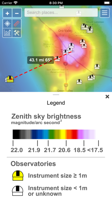
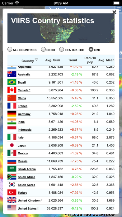
The map displays VIIRS/World Atlas/Clouds/Aurora/IAU observatories and the user SQM measurements. The primary use is to show VIIRS/DMSP data in a friendly manner, but over time it also included some other interesting overlays that concern light pollution like SQM/SQC, World Atlas 2015 zenith brightness, clouds, aurora and IAU observatories. If you have a permanent SQM reader installed you can add it to the map by sending me an e-mail. Please send comments and requests for new features via email (look under help) Functionalities: - VIIRS, Sky Brightness, World Atlas 2015, Cloud coverage and Aurora forecast layers - VIIRS and Sky Brightness layers can be displayed in color blind friendly colors - Road & Satellite base maps - Cloud animation for the last 12 hours - Get detail radiance and SQM values from layers at a click. For Sky brightness/World Atlas 2015, you also get Bortle class estimation. - SQM, SQM-L, SQC, SQM-LE, SQM readings submitted by users - International dark sky parks overlay - Submit your own SQM (L) readings - Observatories layer - Save your favorite locations - Distance measurement tool with azimuth angle report - All-sky view of light pollution with real horizon - Offline mode (Sky brightness map and a base map are saved to your device, so it will be displayed when you are offline)
Installs
Apple does not publish download counts. Estimates are in testing.
We publish iOS estimates only after they pass a back-test against real numbers. Chart history below is measured.
Estimated store revenue Estimated Beta
App Store, worldwide, monthly rate from the last 13 chart days to 20 Nov 2026
Below the top 100 grossing apps in the markets we calibrate. In the United States that usually means under about $6.4M a month. App Store purchases and subscriptions only, before Apple's 15 to 30% fee. Ads and web payments are not included.
Ratings
45 ratings, 45 reviews
No rating breakdown published for this app.
Recent reviews
Latest public reviews from the store
No reviews in our sample for this app yet.
Top chart positions
Latest App Store chart ranks by country, last 10 days
- Countries ranked
- 49 of 50
- Best rank
- #2
- Top 10 placements
- 2
- of 57 chart placements
- Average rank
- #61.2
Best countries on App Store
- 🇵🇹 Portugal · Top paid, Navigation#2
- 🇸🇦 Saudi Arabia · Top paid, Navigation#6
- 🇰🇷 South Korea · Top paid, Navigation#26
- 🇭🇺 Hungary · Top paid, Navigation#34
- 🇵🇱 Poland · Top paid, Navigation#35
- 🇮🇳 India · Top paid, Navigation#35
| Country | Chart | Category | Rank | Best (10 days) | Date |
|---|---|---|---|---|---|
| 🇵🇹 Portugal | Top paid | Navigation | #2 | #2 | 20 Nov 2026 |
| 🇸🇦 Saudi Arabia | Top paid | Navigation | #6 | #6 | 20 Nov 2026 |
| 🇰🇷 South Korea | Top paid | Navigation | #26 | #25 | 20 Nov 2026 |
| 🇭🇺 Hungary | Top paid | Navigation | #34 | #2 | 20 Nov 2026 |
| 🇵🇱 Poland | Top paid | Navigation | #35 | #9 | 20 Nov 2026 |
| 🇮🇳 India | Top paid | Navigation | #35 | #30 | 20 Nov 2026 |
| 🇦🇺 Australia | Top paid | Navigation | #39 | #14 | 20 Nov 2026 |
| 🇬🇧 United Kingdom | Top paid | Navigation | #43 | #9 | 19 Nov 2026 |
| 🇪🇸 Spain | Top paid | Navigation | #44 | #7 | 20 Nov 2026 |
| 🇮🇱 Israel | Top paid | Navigation | #46 | #45 | 20 Nov 2026 |
Light Pollution Map history
Release, install milestones, listing and store changes
- First released on the store 20 Sep 2020
Update frequency
How often Light Pollution Map ships a new version, month by month
2 updates in the last 12 months. More often than most similar apps: they shipped a median of 0 updates in the same year.
Recent versions
Current version 1.1.39
- Version 1.1.3929 May 2026
- Feature filters can be now be saved (settings). Name field also supports wildcard searching for example '*town OR john*' will display 'Smalltown' and 'Johnstown'. - 'My locations' can now be saved (and edited) and restored from a file. - 'My locations' now also available as a feature overlay, so you can view them on the map. - Changing dates in the calendar widget doesn't open virtual keyboard anymore (except when you tap on hour/minute fields). - Other minor changes and bug fixes.
- Version 1.1.388 May 2026
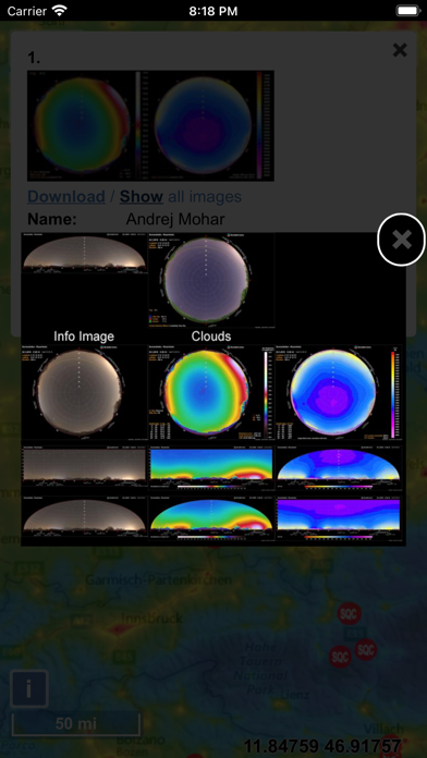
- Sky brightness simulation: added a function that generates an all-sky image that takes into account the drawn polygon radiance modification. That way you can see the effect of the modification on the sky brightness distribution across the entire sky, not just at the zenith. - Added NELM as an alternative unit for sky brightness display for Sky brightness and World Atlas overlays. You can toggle between NELM and MPSAS by clicking the 'SQM' text in the point info window. - Added a 'Save' button to the generated all-sky image, so you can save it directly to your device. - Other minor fixes.
Listing keywords
Words and phrases Light Pollution Map repeats most in its store listing
Top phrases: sky brightness (4), world atlas (4), light pollution (3), brightness world atlas (2), sky brightness world (2).
Highlighted words also appear in the title. Counts cover the title, short description and description.
Compliance
What the listing and the app package show
- Store status
- Live
- Upkeep
- Updated 29 May 2026
- Age rating
- 4+
Apps like Light Pollution Map
 Busly (Legacy)Alex Perez★ 3.94
 MCAT myStopAvail Technologies★ 4.7
 You Need A MapGrangerFX★ 4.4
 DfenceInnovative Aftermarket Group★ 3.42
 TripREC Driving Recorder正选 董★ 4.36
 DriveWell Go™Cambridge Mobile Telematics Inc.★ 3.42
 Street View - Map NavigationTrinh Mai Luong★ 2.87
 Family & Friend: Find LocationBob White★ 4.47
 EVmatchEVMatch★ 3.7
Light Pollution Map: questions and answers
Who makes Light Pollution Map?
Light Pollution Map is published by Jurij Stare.
When was Light Pollution Map last updated?
The latest version (1.1.39) was released on 29 May 2026.
Is Light Pollution Map free?
No. Light Pollution Map is a paid app priced at $4.99.
Is Light Pollution Map still available?
Yes. Light Pollution Map is live on App Store as of 1 Jul 2026.
Track Light Pollution Map and its competitors
Watch any app for new versions, rating drops, chart moves and removals. Free plan, no card.