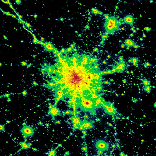
Light pollution map
Explore a light pollution map to find suitable dark sky locations for observing.
- Installs
- 6.79K
- Measured
- Rating
- 4.36
- Ratings
- 81
- 8 reviews
- Version
- 1.1.42
- Updated 29 May 2026
- Released
- 5 Sep 2020
- Tracked since 13 May 2026
- Size
- 9 MB
- Needs 5.1
Also on App Store: Light Pollution Map (45 ratings), Light Pollution Map
Screenshots


About Light pollution map
The description on the store listing
Light Pollution Map helps you easily find the darkest places nearby by combining high-resolution VIIRS satellite data with an interactive global map. Explore sky brightness, compare light pollution levels, and plan the perfect dark-sky trip or astrophotography session.
Whether you’re an astronomer, astrophotographer, stargazer, traveler, or simply curious about night sky quality, this map gives you access to the most accurate and up-to-date night-time light data available.
Key Features
• Interactive light pollution map with VIIRS (Black Marble 2.0) satellite radiance
• Accurate sky brightness and dark sky map overlays (with color blind option)
• Various mapping tools (point/area …
Read the full description
Light Pollution Map helps you easily find the darkest places nearby by combining high-resolution VIIRS satellite data with an interactive global map. Explore sky brightness, compare light pollution levels, and plan the perfect dark-sky trip or astrophotography session. Whether you’re an astronomer, astrophotographer, stargazer, traveler, or simply curious about night sky quality, this map gives you access to the most accurate and up-to-date night-time light data available. Key Features • Interactive light pollution map with VIIRS (Black Marble 2.0) satellite radiance • Accurate sky brightness and dark sky map overlays (with color blind option) • Various mapping tools (point/area info, moon info, brightness simulation, find closest dark site, VIIRS country stats, adding your own SQM measurements, etc...) • MPSAS (magnitude per square arc second) and Bortle scale estimation for easy comparison • Switch between multiple light pollution datasets • Global coverage with high detail • Additional layers such as Aurora (with prediction), Clouds, user submitted SQM, etc... • Offline-friendly — (World Atlas 2015 can be cached) • Find dark sky locations for astronomy, camping & astrophotography • Compare historical VIIRS data and track how light pollution changes • Intuitive, fast map with smooth controls and fullscreen mode • Clean, privacy-respecting design (no ads, no tracking) VIIRS Satellite Data The app uses NASA VIIRS Day/Night Band data — the same scientific dataset used by research institutions and environmental agencies for monitoring night-time brightness. This ensures maximum accuracy when evaluating artificial sky glow. Find Dark Sky Locations Quickly identify dark places for: • Astrophotography • Stargazing • Camping trips • Milky Way observations • Meteor shower watching • Light pollution research • Aurora spotting Why This App? Light Pollution Map offers a clear, easy-to-read view of global sky brightness without ads or unnecessary features. It focuses purely on delivering the most accurate light pollution map possible — ideal for both hobbyists and professionals. No subscription or other hidden fees. Once you buy it, you have it for life with any update that follows. You can explore the map on the official website to see how the data looks: https://www.lightpollutionmap.info The mobile app provides offline mode, GPS integration, and smoother performance.
Installs since 26 Aug 2026 Measured
Exact Google Play install counts, collected daily
Ratings
81 ratings, 8 reviews
- 5 ★79%
- 4 ★4.2%
- 3 ★4.2%
- 2 ★4.2%
- 1 ★8.3%
Recent reviews
Latest public reviews from the store
- 11 Dec 2025
Had same awesome experiences thanks to this. Real treasure .
- 27 Sep 2025
wonderful all I use all the time for trip planning and photography
- 27 Aug 2025
Very accurate ! Find Darker Skies sooner with this App !!
- 16 Apr 2025
Im happy ! This app is welll design! There is still space to improve but its worth .
What reviewers bring up
Topics mentioned in the latest 20 reviews, by how many reviews mention them
Liked in good reviews (18 reviews)
- map 6
- accurate 4
- light pollution 3
- looking 2
- skies 2
- find 2
- data 2
- web 2
Raised in bad reviews (1 reviews)
No topic comes up twice.
Top chart positions
Latest Google Play chart ranks by country, last 10 days
Not in any tracked top chart in the last 10 days.
Light pollution map history
Release, install milestones, listing and store changes
- Reached 5,000+ installs 10 Apr 2025
- Reached 1,000+ installs 18 Nov 2021
- Reached 500+ installs 15 May 2021
- Reached 100+ installs 19 Oct 2020
- Reached 50+ installs 29 Sep 2020
- Reached 10+ installs 14 Sep 2020
- First released on the store 5 Sep 2020
Update frequency
How often Light pollution map ships a new version, month by month
4 updates in the last 12 months. More often than most similar apps: they shipped a median of 0 updates in the same year.
Recent versions
Current version 1.1.42
- Version 1.1.4229 May 2026
- Feature filters can be now be saved (settings). Name field also supports wildcard searching for example '*town OR john*' will display 'Smalltown' and 'Johnstown'. - 'My locations' can now be saved (and edited) and restored from a file. - 'My locations' now also available as a feature overlay, so you can view them on the map. - Changing dates in the calendar widget doesn't open virtual keyboard anymore (except when you tap on hour/minute fields). - Other minor changes and bug fixes.
- Version 1.1.417 May 2026
- Sky brightness simulation: Also generates an all-sky image that takes into account the drawn polygon radiance modification. - Added NELM as an alternative unit for sky brightness display for Sky brightness and World Atlas overlays. You can toggle between NELM and MPSAS by clicking the SQM text in the point info popup. - Added a 'Save' button to the generated all-sky image, so you can save it directly to your device. - Other minor fixes.
- Version 1.1.4020 Apr 2026
- Version 1.1.3918 Mar 2026
Listing keywords
Words and phrases Light pollution map repeats most in its store listing
Top phrases: light pollution (10), light pollution map (6), pollution map (6), dark sky (5), dark sky locations (3).
Highlighted words also appear in the title. Counts cover the title, short description and description.
Business model and tech
From the store listing, the SDKs in the app package and its declared permissions
- Business model
- Paid, $5.49
- Built with
- Cordova
- Ad networks (0)
- None detected
- Sensitive access
- LocationPhotos, videos and files
0 ad, attribution and analytics SDKs detected. SDKs are read from the app package and permissions from the store listing, so code that loads later is not seen.
Technology
23 SDKs found in the app package
7 permissions
0 special access, 4 sensitive, 3 standard
- Change or delete shared storageSensitive
- Read shared storageSensitive
- Approximate locationSensitive
- Precise locationSensitive
- Full internet accessStandard
- See network connectionsStandard
- Internal app permissionDYNAMIC_RECEIVER_NOT_EXPORTED_PERMISSIONStandard
Compliance
What the listing and the app package show
- Store status
- Live
- Upkeep
- Updated 29 May 2026
- Registered in
- Slovenia
- Privacy policy
- Linked on the listing
- Advertising
- No ads declared
- In-app purchases
- None declared
- Age rating
- Everyone
- Sensitive permissions
- 4 sensitive of 7
- Location access
- Yes, while in use
- Camera and microphone
- Neither
Apps like Light pollution map
Explorer Helperanisart9.3K installs★ 5.0
Taxi LIFEBIT Master6.2K installs★ 4.4
такси УДАЧА усть-кутBIT Master11.6K installs★ 4.7
Metro Rest - AthensAppakia5K installs★ 4.4
MaxTrackNewmax Technologies13.1K installs★ 3.4
Táxi Londrina ClienteRádio Táxi Faixa Vermelha Londrina19.7K installs★ 3.8
Anchorage People Mover Bus - …MTransit Apps14.5K installs★ 4.15
Address Finder & My LocationHello World Games & Apps38K installs★ 3.8
Live Earth Zoom Weather MapRiva Tech2.5K installs★ 3.71
Light pollution map: questions and answers
How many downloads does Light pollution map have?
Light pollution map has 6,795 installs on Google Play, measured from the store's own count on 18 Nov 2026.
Who makes Light pollution map?
Light pollution map is published by Deneb, Jurij Stare, s.p., a developer based in SI.
When was Light pollution map last updated?
The latest version (1.1.42) was released on 29 May 2026.
Is Light pollution map free?
No. Light pollution map is a paid app priced at $5.49.
Is Light pollution map still available?
Yes. Light pollution map is live on Google Play as of 18 Nov 2026.
Track Light pollution map and its competitors
Watch any app for new versions, rating drops, chart moves and removals. Free plan, no card.